View is north, taken from approximatley 19th Street and Rosser Avenue. Photograph shows: Clark Hall, the A.E. McKenzie Building, the J.R.C. Evans Lecture Theatre, H-Huts, Darrach Hall and Flora Cowan Hall, as well as a number of homes in the area.
See fonds level of the CKX records for custodial history.
Scope and Content
Image consists of an aerial view looking north at the intersection of Highways 1 and 10 and shows the British American dealer located at the intersection.
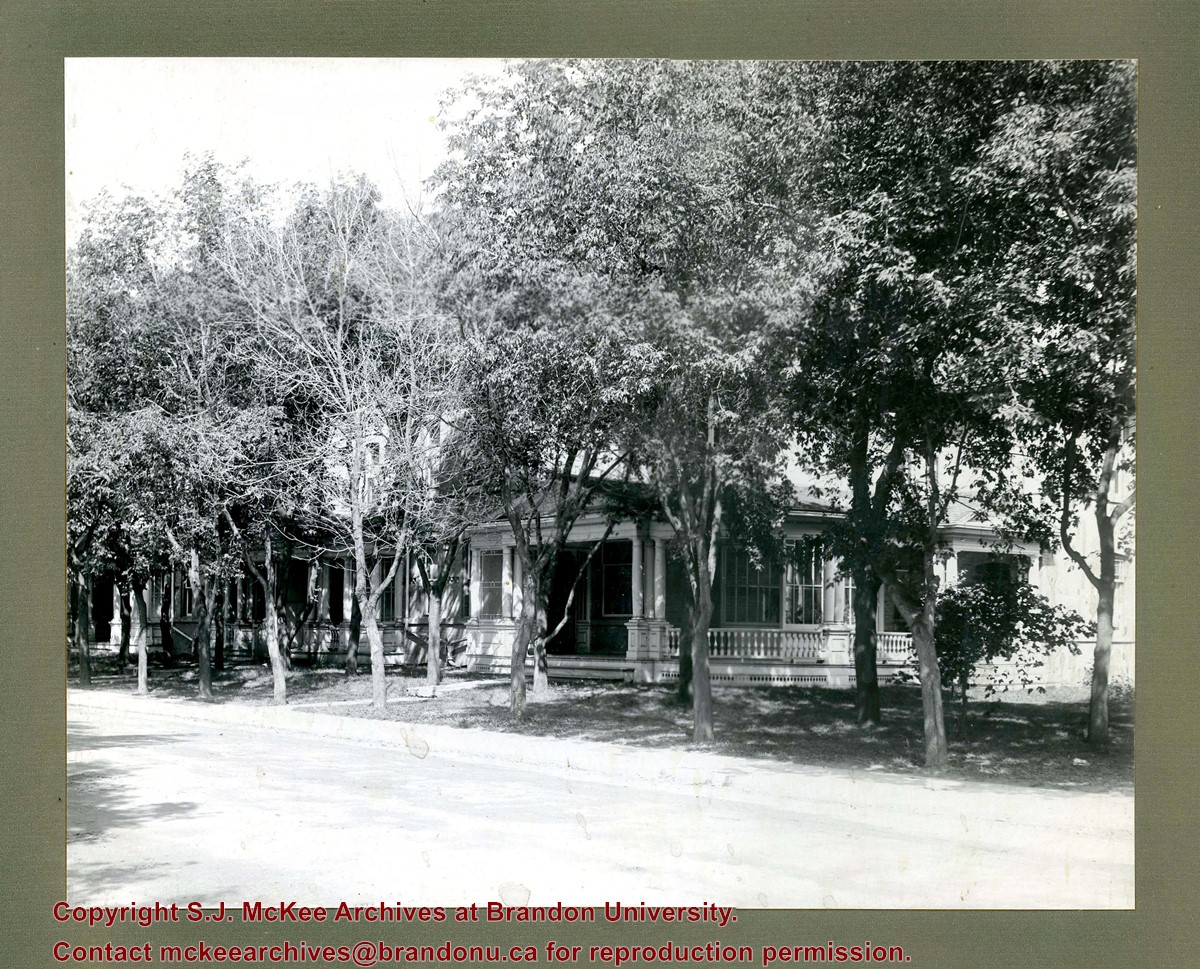
Photograph is looking northwest from approximately the south entrance of the driveway and shows the Citizens' Science Building, the Brandon College Building and part of Clark Hall, as well as the drive way and part of the front lawn.
View is northwest from approximately the corner of 18th Street and Louise Avenue. Photograph shows the Brandon College campus after the completion of Flora Cowan Hall.
Notes
BUPC 2.1.20 is a larger version of this photograph.
Photographs have been glued to a backing board that has warped over time
Custodial History
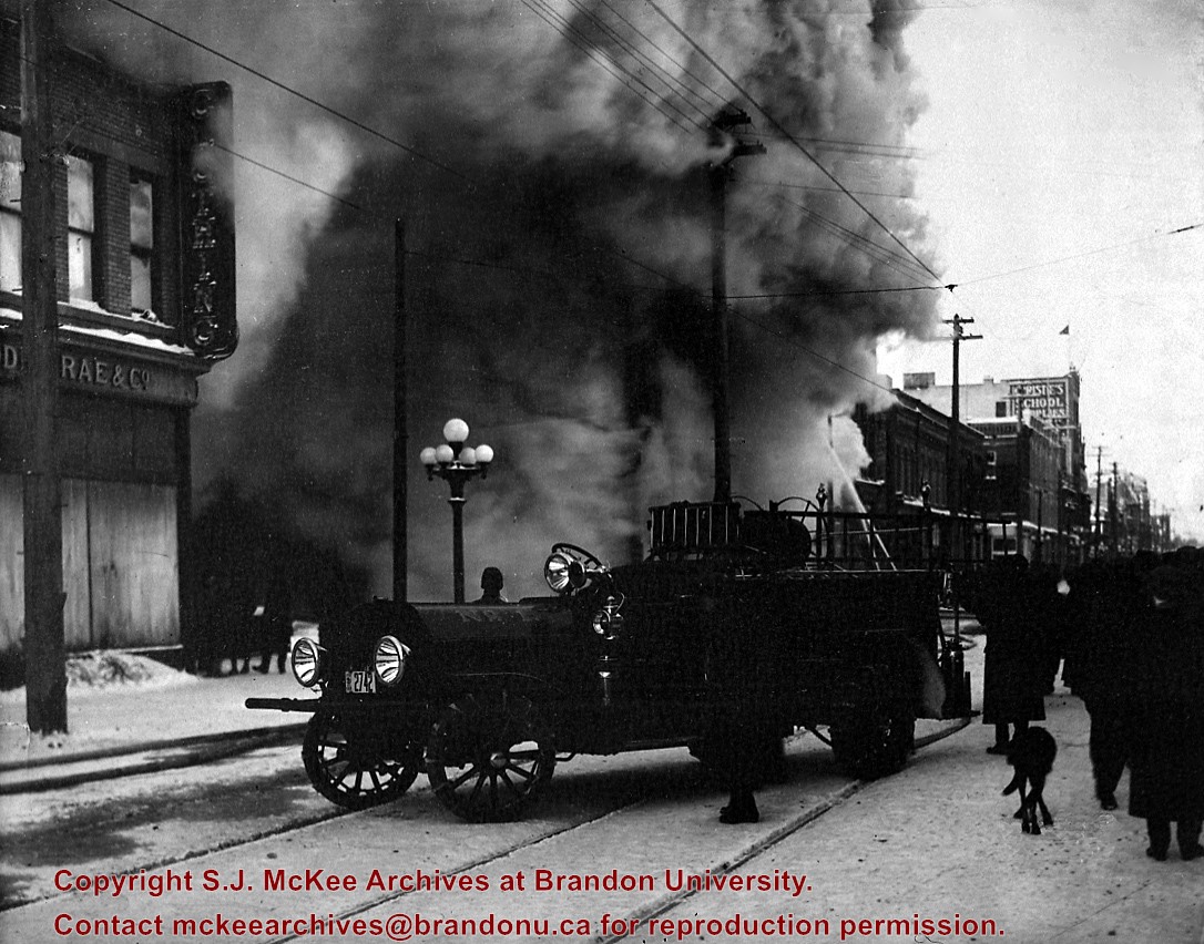
On 16 November 1906, Manitoba was hit by a severe winter storm that began that Thursday evening and extended through the weekend. The Brandon Daily Sun ("Storm Extends Over a Large Territory," 17 Nov. 1906, 1) reported that rail and telegraph services had been disrupted, country roads were impassable, and business in town was at a stand still. Following the weekend, the daily reported the blizzard was one of the greatest in recent memory. CPR trains had been caught in drifts by Carberry and an express car had caught fire and was destroyed ("Worst Storm in Many Years," Brandon Daily Sun, 19 Nov. 1906, 1).
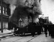
Scope and Content
Photograph shows street view of north side of Rosser Avenue, primarily the 700 block. The Fleming Block, Beaubier Block and its Empire Hotel, A.M. Percival (a grocer), the Brandon Hardware Company (600 block), and the Arlington Hotel (500 block) are visible along the north side of the avenue. The Bank of Hamilton Building on the southeast corner of 8th Street and Rosser appears to be under construction. The streets are muddy and a horse and buggy is traveling west on Rosser Avenue.
Notes
Writing on the front of the photograph matting reads: during the great storm of November 16 1906, 341. The photograph appears to be taken from the interior of a builing on the southwest corner of 7th Street and Rosser Avenue. Page appears to be from a photo album.
Left hand corner of mat is bent. Mock-up instructions are written in pencil at the bottom right hand corner. Portions of the photograph itself are marked with pen.
History / Biographical
The Queen's Hotel was located on the corner of Rosser Avenue and Tenth Street (Steen & Boyce, 1882. Brandon, Manitoba, Canada and Her Industries. Steen & Boyce Publishers Printers & Binders, 81.). Therefore this photo appears to display Rosser Avenue looking east. P.E. 11/06/09
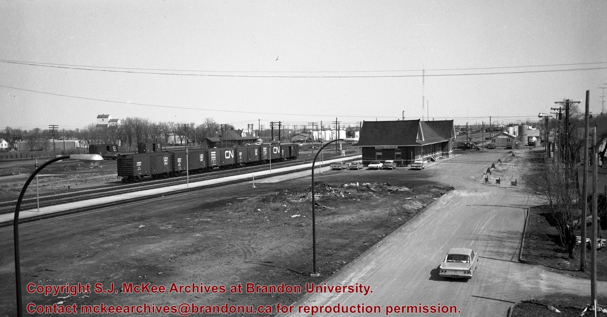
Scope and Content
Photograph shows early Rosser Avenue under construction between 9th Street and 10th Street in the 1880s. Buildings that line the avenue are wood framed and there are wooden boardwalks in front of a few structures. On the north side of Rosser Avenue signs for Fortier & Bucke Commision Agents and Transit House (Hotel) can be seen. On the south side of Rosser Avenue, the Queen's Hotel and Robinson Brothers and Company groceries and dry goods store are open for business. A family appears to be standing on the stoop at the dry goods store. A boy is lounging in the entryway of the Queen's Hotel. A man is standing on a wooden plank that extends across the dirt road of Rosser Avenue between the dry goods store and the commission agents' shop.
Corners of photograph mat are bent. Picture is cracked.
Scope and Content
Photograph shows an early view of Brandon's 6th Street in the 1880s. The Winter & O'Neail Groceries & Provisions and James Smart Hardware storefronts have been photographed. A street sign designating 6th Street can be seen below the Winter & O'Neail sign. A horse and cart is parked in front of the grocery store. A number of men wearing hats and jackets are standing along the boardwalk while posing for the picture. Lumber/timber saws are displayed in teh windows of the hardware store.
Notes
Front of photograph reads: 6th Street, Brandon, Manitoba, 1881-1882, Entrance [to Winter & O'Neail] corner of Rosser Ave & 6th Street.
Photograph shows the 800 block of Rosser Avenue facing west. On the south side of Rosser Avenue the Nation Block, Christie's Bookstore, and Reesor's Clock can be seen. A number of horse and buggies/carriages are travelling along Rosser Avenue.
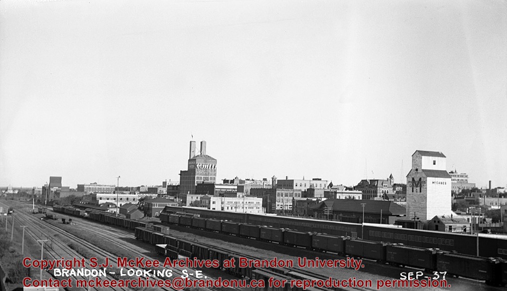
Image is looking east northeast from approximately the 300 block of 23rd Street between Lorne and Louise Avenues. Photograph shows the Brandon College campus after the opening of the original Music Building in 1963, but before the construction of the Education Building in 1966. A number of house on the 300 blocks of 22nd and 21st Streets are visible in the foreground, with the A.E. McKenzie Seed Co., the Prince Edward Hotel and various grain elevators on the horizon.
See fonds level of the CKX records for custodial history.
Scope and Content
Image consists of an aerial view looking southeast at the intersection of Highways 1 and 10 and shows the British American dealer located at the intersection.
See fonds level of the CKX records for custodial history.
Scope and Content
Image consists of an aerial view looking northeast at the intersection of Highways 1 and 10 and shows the British American dealer located at the intersection.


/17-2011_5.jpg?width=1200&404=no-img.jpg&watermark=wmk)
/17-2011_5.jpg?width=180&404=no-img.jpg)
%2f17-2011_5.jpg%3fmaxheight%3d1000%26maxwidth%3d1000%26watermark%3dwmk&description=Barn+Avenue)