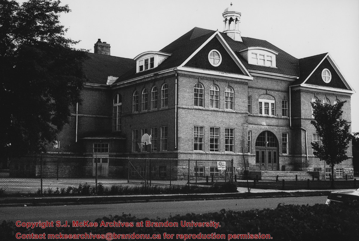
View is northwest from approximately the corner of 18th Street and Louise Avenue. Photograph shows the Brandon College campus after the completion of Flora Cowan Hall.
Notes
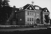
BUPC 2.1.24 is a smaller version of this photograph.
The bottom right hand corner has been torn off. Both portions of the photograph are stored together.
Scope and Content
View is northwest from approximately 17th Street and Victoria Avenue. Photograph shows: the Brandon College campus and the Kinsmen Park and baseball diamond. Taken during construction of Flora Cowan Hall but before the Gymnasium was built.
View is north, taken from approximatley 19th Street and Rosser Avenue. Photograph shows: Clark Hall, the A.E. McKenzie Building, the J.R.C. Evans Lecture Theatre, H-Huts, Darrach Hall and Flora Cowan Hall, as well as a number of homes in the area.
View is northwest from approximately the corner of 18th Street and Louise Avenue. Photograph shows the Brandon College campus after the completion of Flora Cowan Hall.
Notes
BUPC 2.1.20 is a larger version of this photograph.
Image is looking east northeast from approximately the 300 block of 23rd Street between Lorne and Louise Avenues. Photograph shows the Brandon College campus after the opening of the original Music Building in 1963, but before the construction of the Education Building in 1966. A number of house on the 300 blocks of 22nd and 21st Streets are visible in the foreground, with the A.E. McKenzie Seed Co., the Prince Edward Hotel and various grain elevators on the horizon.
View is east from approximatley 22nd Street between Lorne and Louise Avenues. Photograph shows: Darrach Hall, Flora Cowan Hall and the Citizens' Science Building, as well as a number of homes in the area.
Image shows the Brandon College campus from 17th Street looking southwest. The photo was taken after the completion of the original Music Building in 1963, but construction of the Education Building. Also visible are a number of properties on the 200 block of 18th Street and the 200 block of 20th Street.
View is west to McDiarmid Drive from approximately 16th Street between Princess and Louise Avenues. Photograph shows: Brandon College, Fleming School, Coronation Park, and West End Community Centre.
View is northwest from the corner of 18th Street and Louise Avenue. Photograph shows the Brandon College campus, the Steam Plant and Kinsmen Stadium. Flora Cowan Hall is under construction.
View is east northeast from approximately 22nd Street between Lorne and Louise Avenues. Photograph shows: Brandon College (before planting of trees in quadrangle and before the Education Building), McKenzie Seeds, Prince Edward Hotel, Central United (St. Paul's) Church, St. Augustine's Church.
The photograph was taken for the Centennial of Brandon College/University.
Scope and Content
Aerial photograph taken looking southwest from approximately the northeast corner of Princess Avenue and 17th Street. The entire campus, as well as a number of residential streets are visible.
View is north northwest from the John R. Brodie Science Center (?). Photograph shows: Citizens' Science Building, Brandon College Building and Clark Hall, the Education Building and the driveway running in front of the buildings.
View is northwest, taken from the John R. Brodie Science Centre. Photograph shows: Citizens' Science Building in the foreground, the Brandon College Building and Clark Hall in the background, as well as the driveway in front of the buildings.
View is northeast, taken from the John R. Brodie Science Centre. Photograph shows: the Brandon College Building, the Student Services H-Hut, the Education Building, and the Student Union Building (Citizens' Science Building), as well as 18th Street and some houses. The trailer to the south of the Education Building was a Canada Manpower office in the 1960s. It was latter moved over by the Gymnasium, where it became the Quill office.
Aerial photographs of the campus were generally commissioned by the College/University to record important milestones, such as centennials, changes in status, and building projects. The general campus photographs were placed in this sub-series because the composition of the images made it difficult to place them with individual buildings.
Scope and Content
Sub-series consists of photographs of the Brandon College and Brandon University campus.
Vining taught Mathematics, Natural Science, History, and Physics at Brandon College from 1900-1918. Vining wrote the lyrics to "Hail Our College;" his wife Abigail wrote the music.
Scope and Content
Photograph shows Arthur Vining standing in front of the steps of either the Brandon College Building or Clark Hall.


