See collection level description for the James Douglas Wall collection.
Scope and Content
Image of the town of Baldur, MB. Visible is the L. Curtis Block. Canadian Northern rail cars are in the foreground with horse drawn carts and men working on road and town buildings behind.
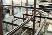
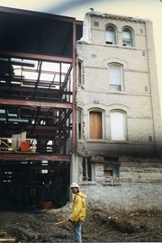
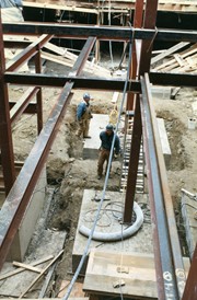
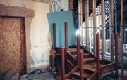
Photograph shows construction on the basement of the Brandon College Building and Clark Hall, including support beams, concrete walls, mounds of dirt and a number of workers.
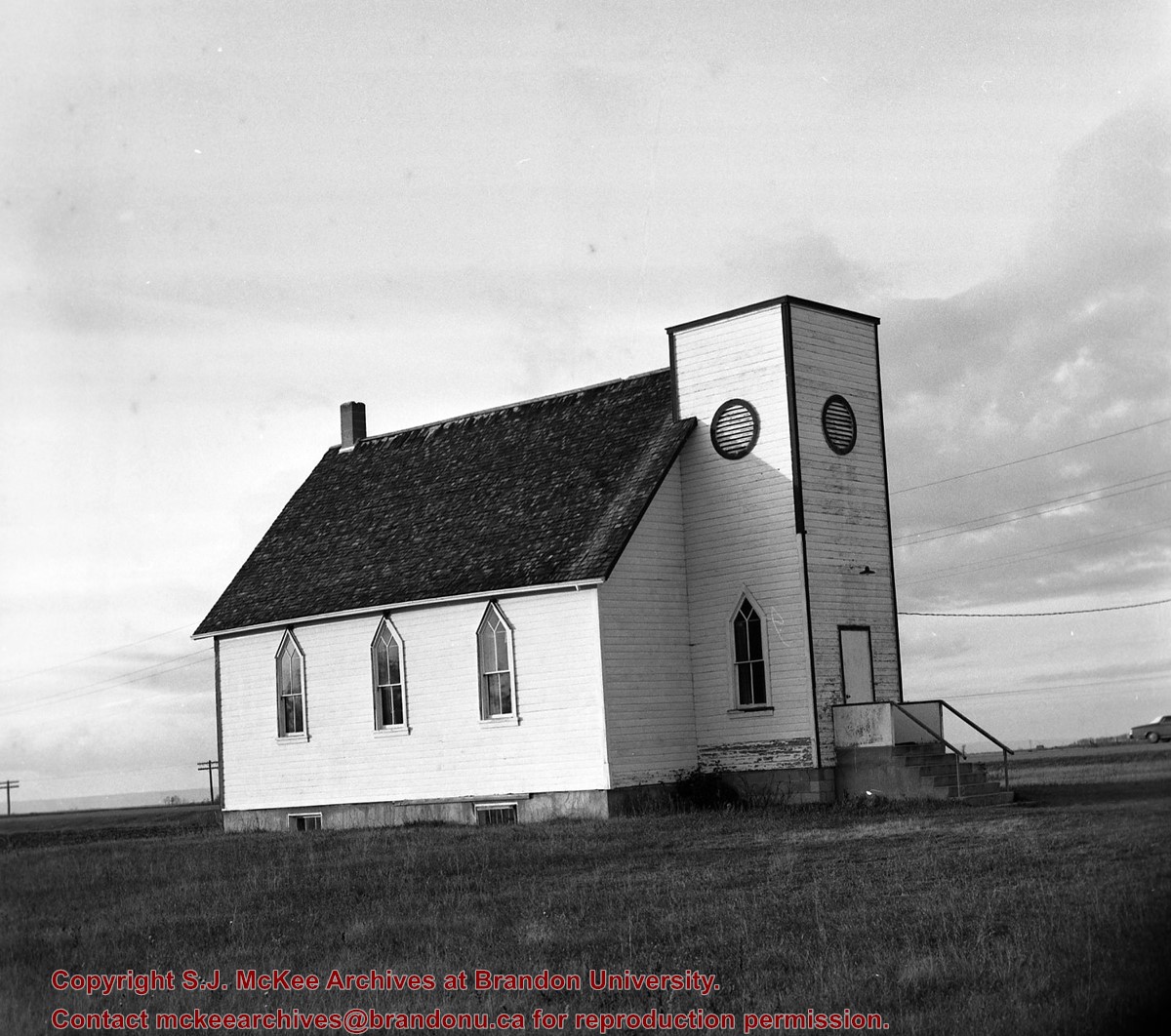
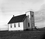
The name Berbank was created by combining the names of two local districts: Riverbank and Bertha. Both were located south of Brandon in the Rural Municipality of Oakland. The Berbank Church was built in 1919. Its construction grew out of the work of the Berbank Red Cross founded in 1917. The Berbank Church was a "union" church, constructed in anticipation of the formation of the United Church of Canada. In 1966, the Berbank congregation joined with the Nesbitt congregation to operate out of the Nesbitt United Church. The final service at the Berbank United Church was held in 1966.
Custodial History
This fonds was accessioned by the McKee Archives in 1997. Prior custodial history is unknown.
Scope and Content
Fonds contains a document titled "Berbank Church History." This document is partially in a printed format with a portion handwritten. Fonds also contains minute books and legal documents pertaining to the ownership of the land upon which the Church was constructed.
Berbank Women's Aid was founded in 1919. It was, in large part, the Berbank Red Cross under a new name. The principal project of the original Berbank Ladies Aid was the construction of the Berbank Church, which was accomplished in 1919. In 1962, the organization was renamed the Berbank United Church Women. With the closing of the Berbank church in 1966, the Berbank United Church Women were dissolved.
Custodial History
This fonds was accessioned by the McKee Archives in 1997. Prior custodial history is unknown.
Scope and Content
This fonds consists of various minute books of the Berbank Ladies Aid, and its successor organization, dating from 1919 to 1965.
The Bertha School District, located south of Brandon in the Rural Municipality of Oakland, was established in 1896. It was integrated into the School Distict of Nesbitt in 1961. Subsequently, it became part of the Souris Valley School Division.
Custodial History
This fonds was accessioned by the McKee Archives in 1998. Prior custodial history is unknown.
Scope and Content
Fonds consists of annual registers (1910-1961), minute books (1896-1962), account books (1896-1911, 1924-1956), an award of a Board of Arbitration (1961), a petition for consolidation with the School District of Nesbitt (1961), a financial report (1961), a map of the Souris Valley School Division showing rural school districts, and one debenture certificate (1896).
For custodial history see the collection level description of the Lawrence Stuckey collection.
Scope and Content
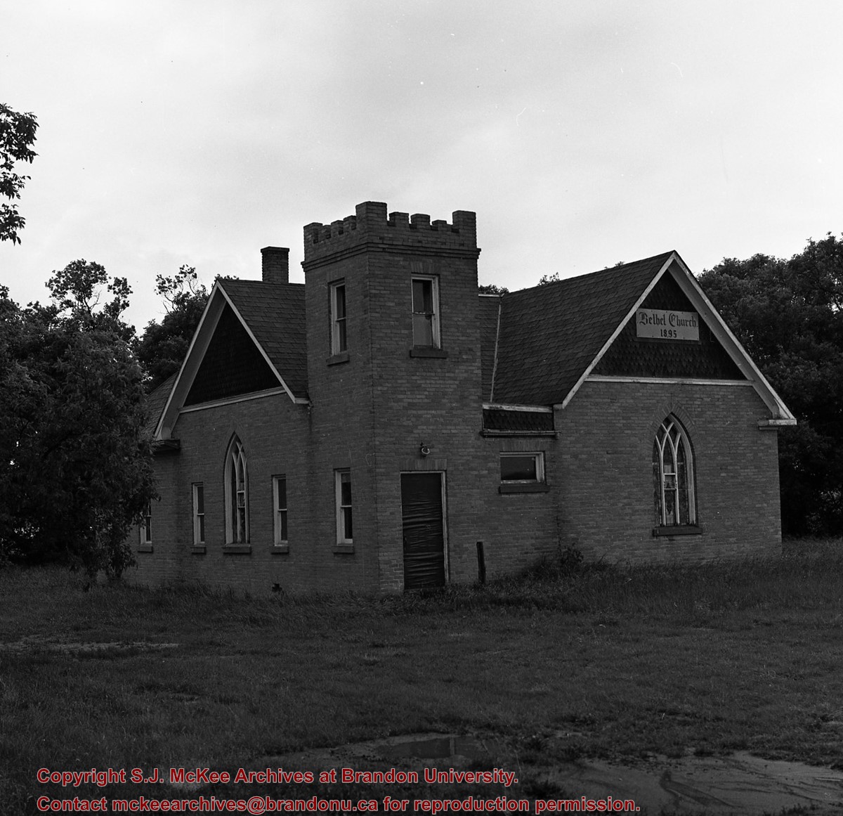
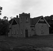
Image of Bethel Church (1895) on Highways 2 & 21 west of Deleau, Manitoba.
Notes
[Brandon SW includes communities south of Trans-Canada #1 highway and west of PTH #10.] [Images 349a and 349b are images of the exterior of the church, and images 349c-349-e are images of the stained glass windows.]
For custodial history see the collection level description of the Lawrence Stuckey collection.
Scope and Content
Image of Bethel Church (1895) on Highways 2 & 21 west of Deleau, Manitoba.
Notes
[Brandon SW includes communities south of Trans-Canada #1 highway and west of PTH #10.] [Images 349a and 349b are images of the exterior of the church, and images 349c-349-e are images of the stained glass windows.]
/12-2004_14.jpg?width=1200&404=no-img.jpg&watermark=wmk)
/12-2004_14.jpg?width=180&404=no-img.jpg)
/12-2004_13.jpg?width=1200&404=no-img.jpg&watermark=wmk)
/12-2004_13.jpg?width=180&404=no-img.jpg)
/12-2004_15.jpg?width=1200&404=no-img.jpg&watermark=wmk)
/12-2004_15.jpg?width=180&404=no-img.jpg)
/12-2004_7.jpg?width=1200&404=no-img.jpg&watermark=wmk)
/12-2004_7.jpg?width=180&404=no-img.jpg)
/12-2004_6.jpg?width=1200&404=no-img.jpg&watermark=wmk)
/12-2004_6.jpg?width=180&404=no-img.jpg)


/12-2004_17.jpg?width=1200&404=no-img.jpg&watermark=wmk)
/12-2004_17.jpg?width=180&404=no-img.jpg)
/12-2004_29.jpg?width=1200&404=no-img.jpg&watermark=wmk)
/12-2004_29.jpg?width=180&404=no-img.jpg)


%2f12-2004_14.jpg%3fmaxheight%3d1000%26maxwidth%3d1000%26watermark%3dwmk&description=Baldur%2c+Manitoba+from+southwest)
%2f12-2004_13.jpg%3fmaxheight%3d1000%26maxwidth%3d1000%26watermark%3dwmk&description=Baldur%2c+Manitoba+-+snow+on+the+ground)
%2f12-2004_15.jpg%3fmaxheight%3d1000%26maxwidth%3d1000%26watermark%3dwmk&description=Baldur%2c+Manitoba+spring+flood)
%2f12-2004_7.jpg%3fmaxheight%3d1000%26maxwidth%3d1000%26watermark%3dwmk&description=Baldur%2c+MB)
%2f12-2004_6.jpg%3fmaxheight%3d1000%26maxwidth%3d1000%26watermark%3dwmk&description=Baldur%2c+MB+from+south)
%2f12-2004_17.jpg%3fmaxheight%3d1000%26maxwidth%3d1000%26watermark%3dwmk&description=Bateman+house+-+Baldur%2c+MB)
%2f12-2004_29.jpg%3fmaxheight%3d1000%26maxwidth%3d1000%26watermark%3dwmk&description=Benedict+Anderson+-+Baldur%2c+MB)
+on+Highway+2-21+near+Hartney+Junction)
+on+Highways++2+%26+21+west+of+Deleau%2c+Manitoba.)
+on+Highways++2+%26+21+west+of+Deleau%2c+Manitoba.)
+on+Highways++2+%26+21+west+of+Deleau%2c+Manitoba.)
+on+Highways++2+%26+21+west+of+Deleau%2c+Manitoba.)