Built in 1991-1992 for $1.4 million, the official opening of the Centre was May 29, 1992. The centre is currently (April 2010) called the Addictions Foundation of Manitoba, Parkwood Centre.
Custodial History
For custodial history see the collection level description of the Lawrence Stuckey collection.
Scope and Content
Alcoholism Foundation of Manitoba (AFM), Parkwood Treatment Centre located on Victoria Avenue East.
Built in 1991-1992 for $1.4 million, the official opening of the Centre was May 29, 1992. The centre is currently (April 2010) called the Addictions Foundation of Manitoba, Parkwood Centre.
Custodial History
For custodial history see the collection level description of the Lawrence Stuckey collection.
Scope and Content
Alcoholism Foundation of Manitoba (AFM), Parkwood Treatment Centre.
ARCH 2: North Lauder Locale
The North Lauder locale has a long archaeological and geological history that is important for understanding the forces that shaped the region. Archaeological research in the locale shows that the area has been occupied by humans for at least the past 6,500 years. Environmental forces provided an area of diverse resources that attracted early peoples.
Environment of the Lauder Sandhills
The North Lauder locale is part of the greater Lauder Sandhills area. The glaciers that covered this region began to recede approximately 11,000 years ago leaving a large lake known as glacial Lake Hind. The Souris River, the Lauder Sandhills and the Oak Lake Aquifer are remnants of the environmental and geological forces that shaped the region.
The Lauder Sandhills region is characterized by a landscape of sand sheets and stabilized sand dunes interspersed with a variety of wetlands. This complex topographic and hydrological situation favoured the development of an island mosaic of mixed forest, wetland and meadow, surrounded by mixed grass prairie. The result was a large, isolated ecotone which provided a rich variety of subsistence resources for hunter-gatherers.
Research in the Lauder Sandhills
Archaeologists from Brandon University have been conducting research in the Lauder Sandhills since 1991. Research in the North Lauder locale has focused on the Atkinson site, a 6,500 year old hunter-gatherer site and Flintstone Hill.
The Atkinson site
The Atkinson site is one of the oldest excavated sites in Manitoba and has been Radiocarbon dated to 6,500 years before present. The Atkinson site is located on the bank of the Souris River and was discovered when a hearth (fire pit) was seen eroding out of the bank. Based on the date of the site and the kind of lithics (stone tools) present it is considered a Gowen occupation. The Atkinson site is evidence that bison hunters were active on the northern plains at a very early date. Similar sites have also been found on the High Plains in the U.S. and are referred to as the Mummy Cave Complex.
The Atkinson Site is of great importance as it is the first undisturbed site of this type to be excavated in Manitoba and extends the range of these sites south and east from the type-sites in central Saskatchewan.
Flintstone Hill
The geomorphology of the glacial Lake Hind Basin over the past 11,000 years is known primarily through the study of a cut bank along the Souris River. Flint Stone Hill contains the most complete stratigraphic record for the post-glacial period on the northern plains. The site has been extensively studied by geoarchaeologists, geologists and paleoenvironmentalists over many years and their findings have contributed to our understanding of the region.
The North Lauder locale Borden designations of Atkinson site DiMe-27 and Flintstone Hill site DiMe-26.
Borden System
Archaeological sites in Canada are identified by the Borden system, which is a uniform site designation system. The country is divided into grids based on latitude and longitude in blocks of 10 x 20 minutes. The first 4 letters indicate the block and the following numbers indicate the actual site. For example the area of the Lauder Sandhills in southwestern Manitoba is identified by the letters DM and the North Lauder locale within that area is DiMe. The Atkinson site is DiMe-27 and the Flintstone Hill site DiMe-26. As new sites are discovered they will be numbered sequentially.
Scope and Content
The Series has been divided into two sub-series, including (1) Atkinson site DiMe-27 and Flintstone Hill site DiMe-26.
The Brandon Art Club was founded in November 1907, and operated in an art studio on the top floor of the Brandon College Women's Residence. The club appears to have been the creation of Miss. H. Hancock, who became the Director of the Department of Art at Brandon College c. 1907. The club moved to larger facilities made available at the First Methodist Church; the organization remained there until sometime during the Great War when the club relocated to St. Paul's Presbyterian Church and then in 1921, to the Prince Edward Hotel. The club's first public art exhibitions were held at the Prince Edward Hotel. Art classes were held for the first time in 1928. In 1968, the Brandon Art Club merged with the Allied Arts Center, which had been formed in 1959. The Allied Arts Center was located at 1036 Louise Avenue. In April 1984, the Allied Arts Center was moved to new facilities at the Arts Center of Western Manitoba located at 638 Princess Avenue. In 1989, it was renamed the Art Gallery of Southwestern Manitoba, and began to function as a "professional, regional art gallery." The Art Gallery of Southwestern Manitoba relocated to 2-710 Rosser Ave. c. 2001.
Custodial History
These records were created at different times between 1907 and 1993, and remained in the possession of the administration of the above mentioned organizations until May 2001, when they where donated to the McKee Archives.
Scope and Content
Fonds contains administrative records, minutes, personal files, correspondence, newsletters, photographs, summaries of collections and exhibits, scrapbooks, programs, submitted papers, and other miscellaneous records. All are a record of the growth and evolution of the Art Club, its administration, and of the art community in Brandon.
The A.E. McKenzie Company fonds (RG 3 MG 1, 1.3) located in the McKee Archives contains some records, primarily correspondence and minutes, relating to the Brandon Allied Arts Council.
This bridge was condemned in the late 1930s but cyclists continued to use it until it was torn down (approximately 1940)
Until the early 1920s the Canadian Pacific Railway maintained a well and pumping station near the southeast corner of this bridge, which pumped water through a pipeline to a locomotive watering tank at Kemnay.
Custodial History
For custodial history see the collection level description of the Lawrence Stuckey collection.
Scope and Content
Assiniboine River Bridge North of Kemnay
Notes
[Mr. Stuckey put a negative and print in the same envelope. We have separated them, numbering the negative OB5(1) and the print OB5(1a).]
.jpg?width=1200&404=no-img.jpg&watermark=wmk)
.jpg?width=180&404=no-img.jpg)
.jpg?width=1200&404=no-img.jpg&watermark=wmk)
.jpg?width=180&404=no-img.jpg)


.jpg?width=1200&404=no-img.jpg&watermark=wmk)
.jpg?width=180&404=no-img.jpg)
.jpg?width=1200&404=no-img.jpg&watermark=wmk)
.jpg?width=180&404=no-img.jpg)
.jpg%3fmaxheight%3d1000%26maxwidth%3d1000%26watermark%3dwmk&description=Alcoholism+Foundation+of+Manitoba%2c+Parkwood+Treatment+Centre)
.jpg%3fmaxheight%3d1000%26maxwidth%3d1000%26watermark%3dwmk&description=Alcoholism+Foundation+of+Manitoba+Parkwood+Treatment+Centre)
)
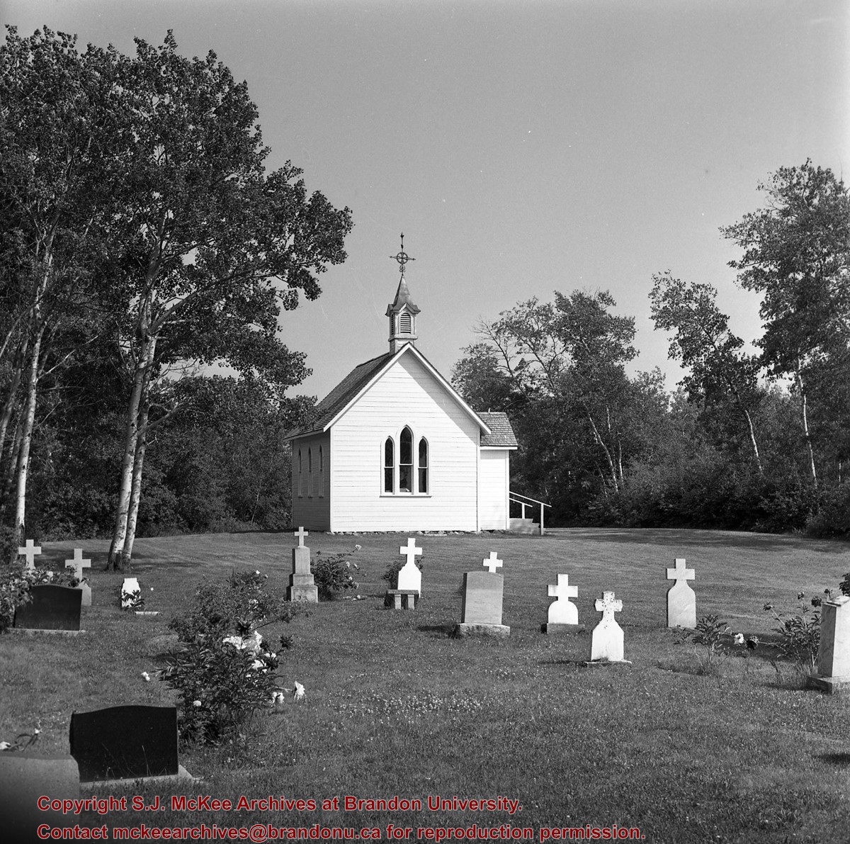
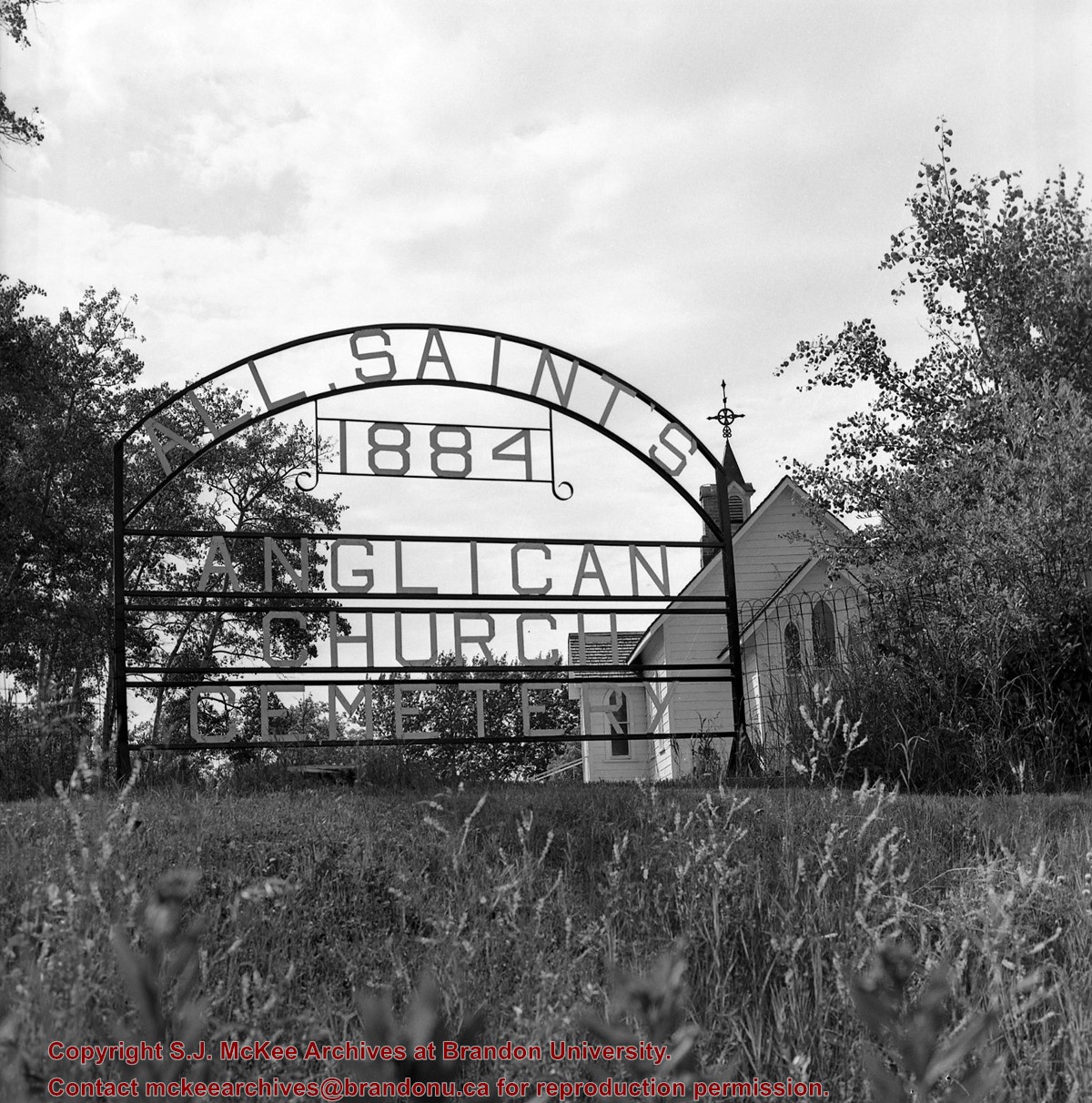
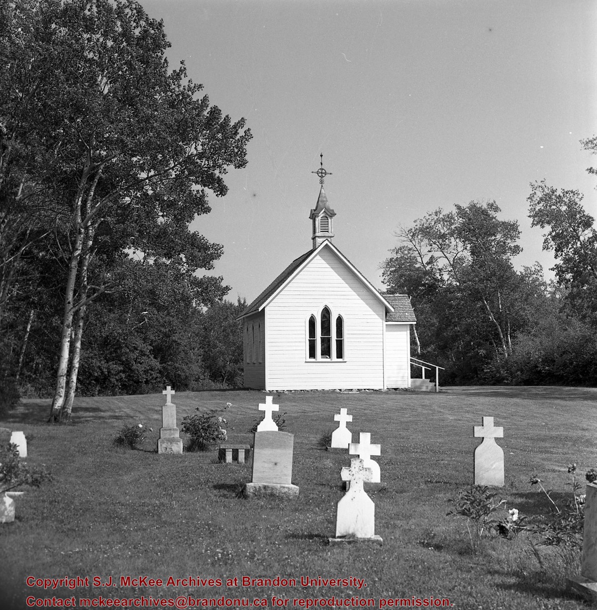
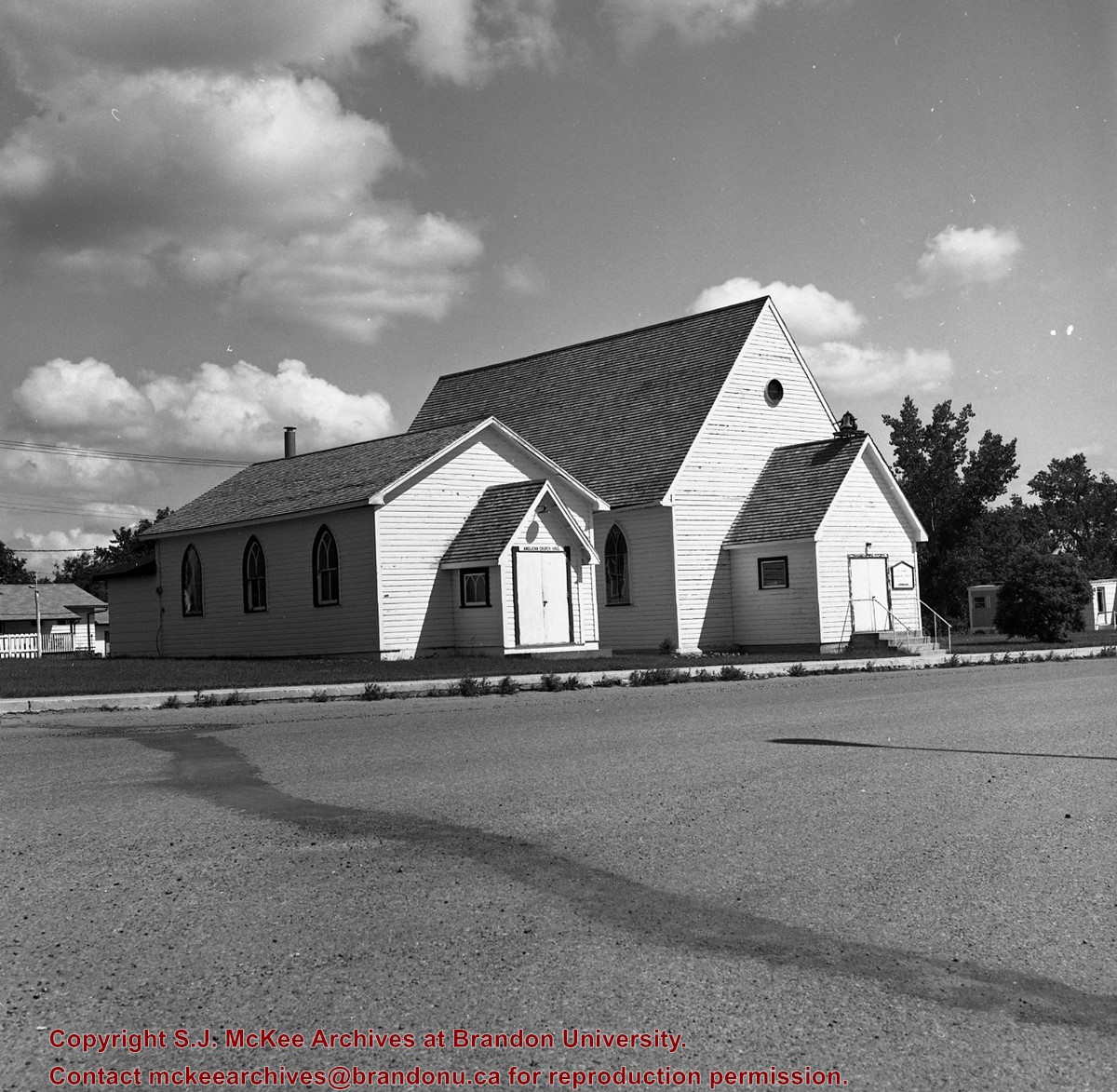
%2c+Gladstone%2c+Manitoba%0a)
%2c+Gladstone%2c+Manitoba%0a)
.jpg%3fmaxheight%3d1000%26maxwidth%3d1000%26watermark%3dwmk&description=Assiniboine+River+Bridge+North+of+Kemnay)
.jpg%3fmaxheight%3d1000%26maxwidth%3d1000%26watermark%3dwmk&description=Assiniboine+River+Bridge+North+of+Kemnay)