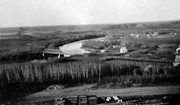
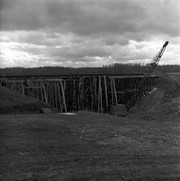
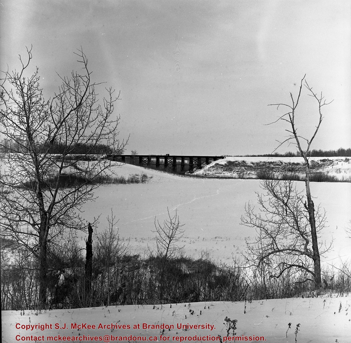
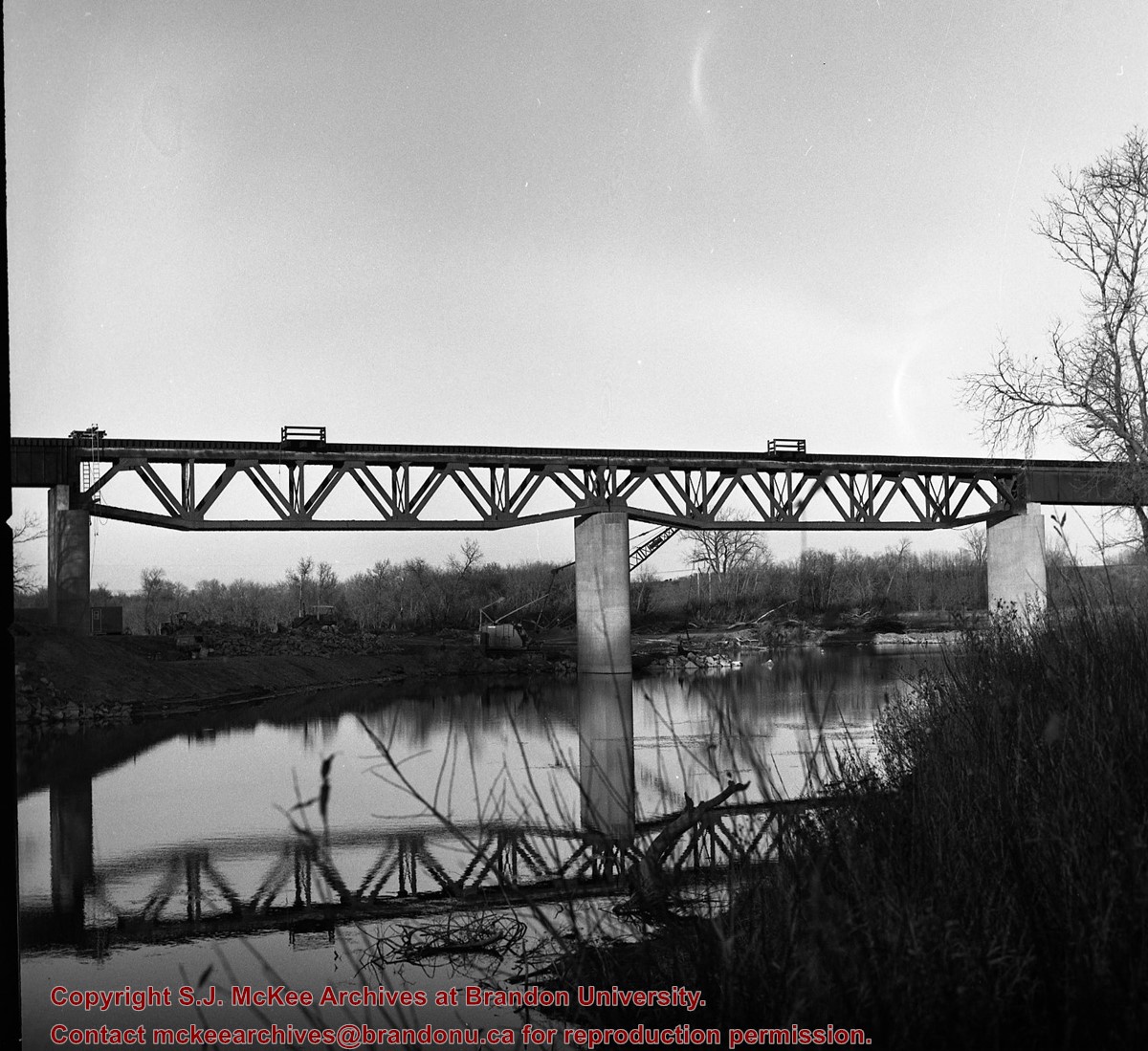
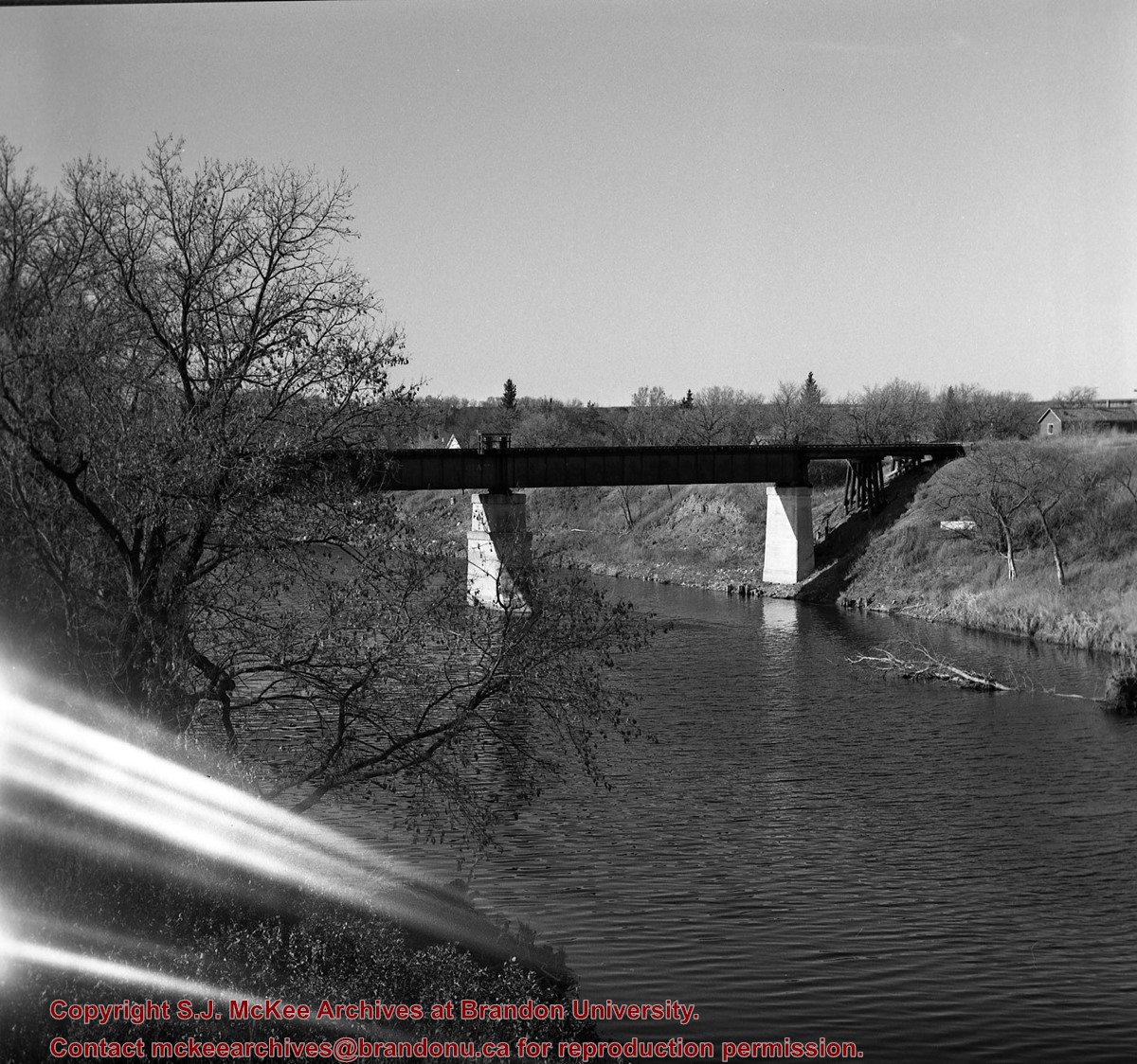
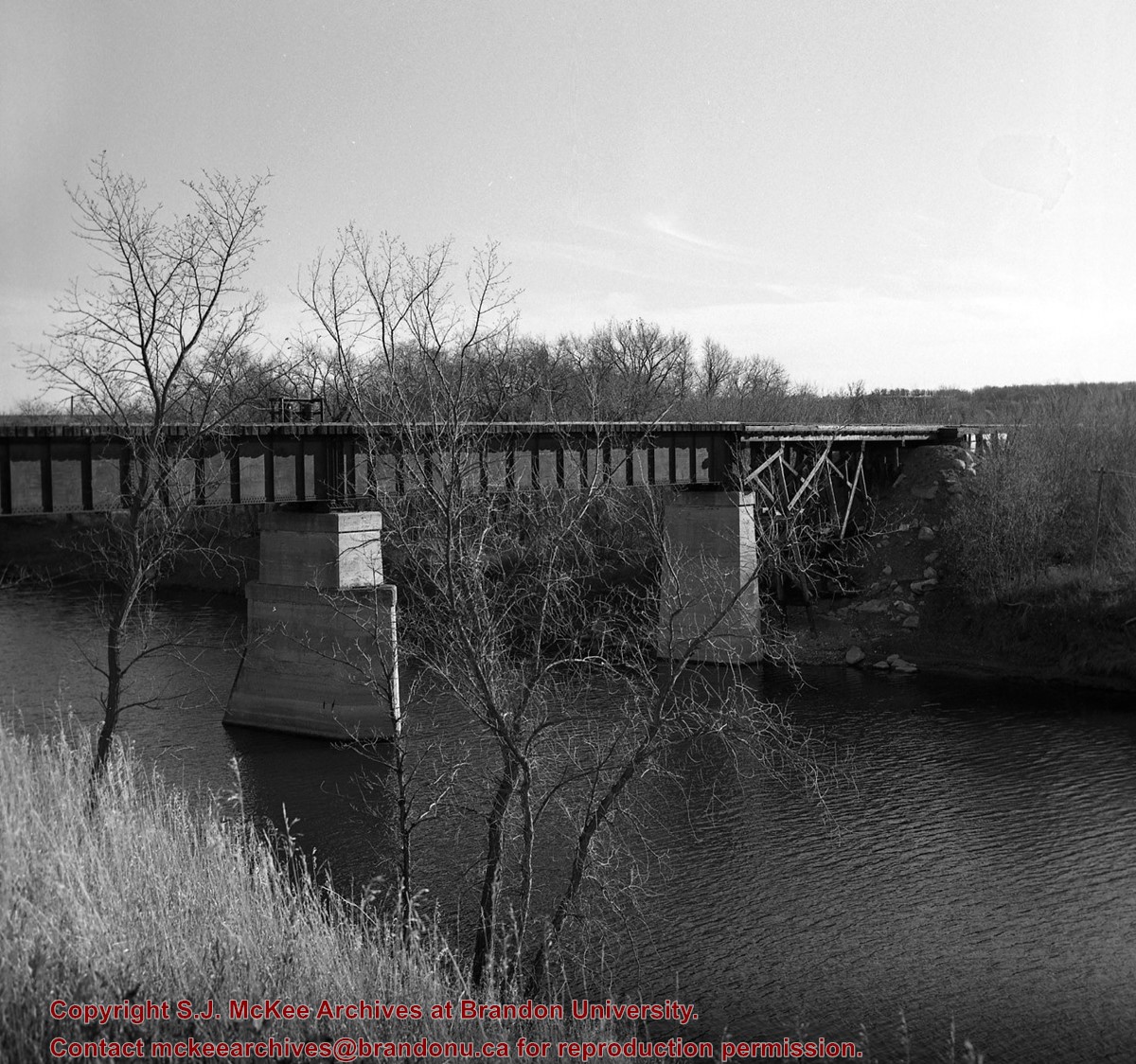
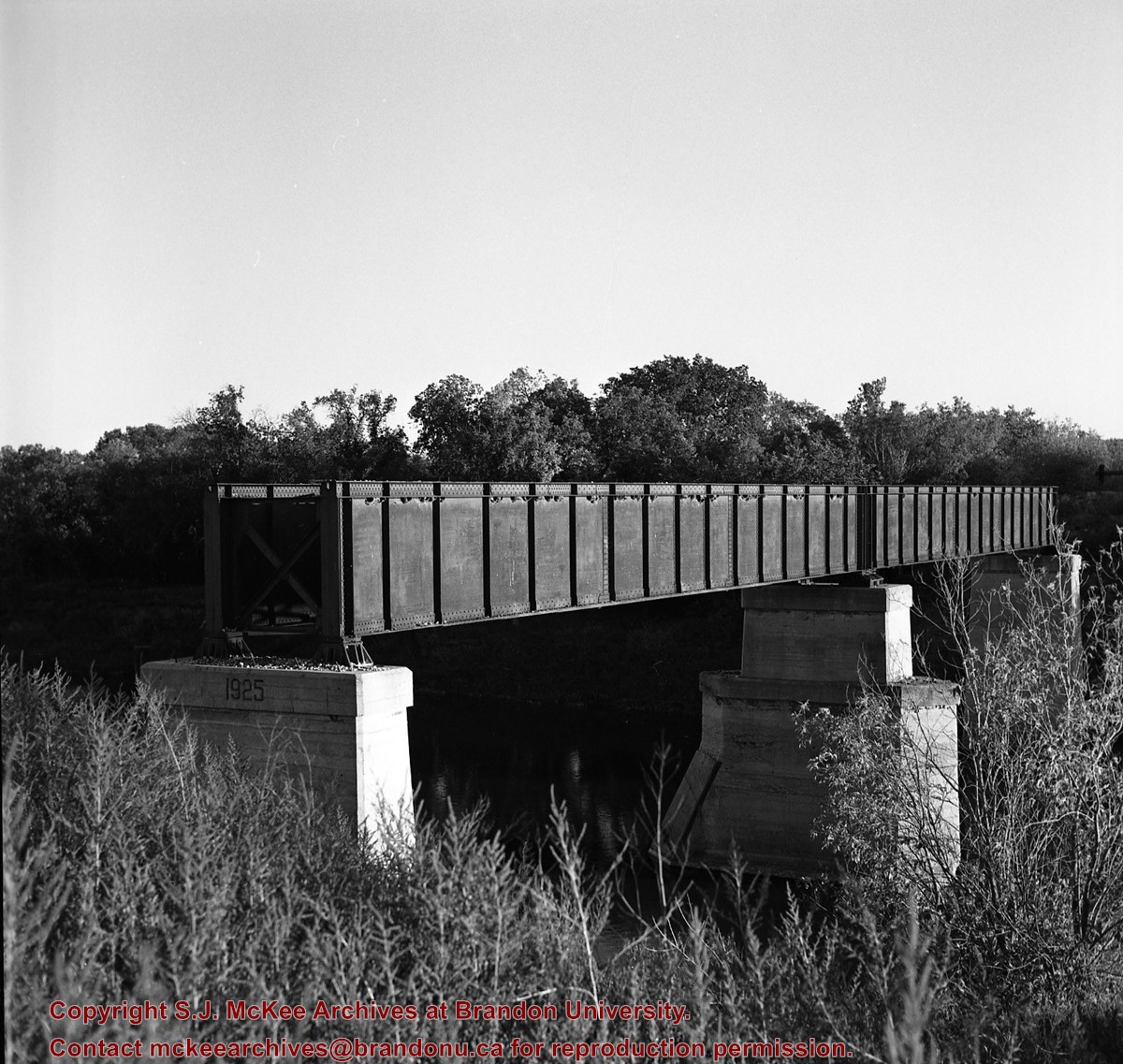
According to Stuckey and Bain (1996), “The Brandon, Saskatchewan & Hudson’s Bay Railway was built and operated as a totally owned subsidiary of the Great Northern Railway. Construction commenced in late 1905 and by the end of 1905, less than a mile of track had been laid north of the boundary at St. John. In 1906, the remaining 68.6 miles to Brandon were laid and service commenced that year. During the Depression of the 1930s, traffic declined significantly and the entire branch was abandoned in 1936. Over much of the branch’s length, the ties and rails were laid on the prairie without ballast and today little remains of the line apart from traces where there were cuts and bridges.” (p. 18)
Stuckey, L. A., & Bain, D. M. (1996). The Great Northern and Northern Pacific railways in Canada. Calgary, Alberta: British Railway Modellers of North America.
Custodial History
For custodial history see the collection level description of the Lawrence Stuckey collection.
Scope and Content
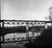
Great Northern (BS&HB) Railway bridge crossing the Souris River at Bunclody, Manitoba.
The overpass is named for Brandon's first mayor, Thomas Mayne Daly, and the street on which the overpass is located. The overpass opened in October 1963.
Scope and Content
Photograph is an aerial view of the Daly 18th Street Overpass (18th Street Bridge). Visible are a number of commercial and residential buildings in the north end of Brandon, MB. The view is northeast, probably taken from the roof of the old steam plant north of 20th Street and Rosser Avenue.
Some damage to matting, especially on the back. Photograph is good. There are two brads in the matting (one on the left edge, one on the right edge). The brads are connected to a (broken) red ribbon likely used to hang the photograph.
Custodial History
Kay Sullivan gave the photograph to Fred McGuinness in August 2007.
Scope and Content
Photograph was taken from the riverbank and shows the steel bridge in Souris, MB. A second wooden bridge is visible behind the steel bridge. The residence of Dr. W.A. Sherrin can be seen to the right of the bridges.
Notes
Dr. Sherrin's residence was identified using the Illustrated Souvenir of Souris, Manitoba (p. 38).
Some damage to matting, especially on the back. There is also significant water damage to the image. There are two brads in the matting (one on the left edge, one on the right edge). The brads are connected to a red ribbon likely used to hang the photograph.
Custodial History
Kay Sullivan gave the photograph to Fred McGuinness in August 2007.
Scope and Content
Photograph was taken from the riverbank and shows the suspension foot-bridge in Souris, MB. A number of buildings, both commerial and possibly residential, can be seen on the far side of the river.
Photograph has been glued to a backing board that has warped over time
History / Biographical
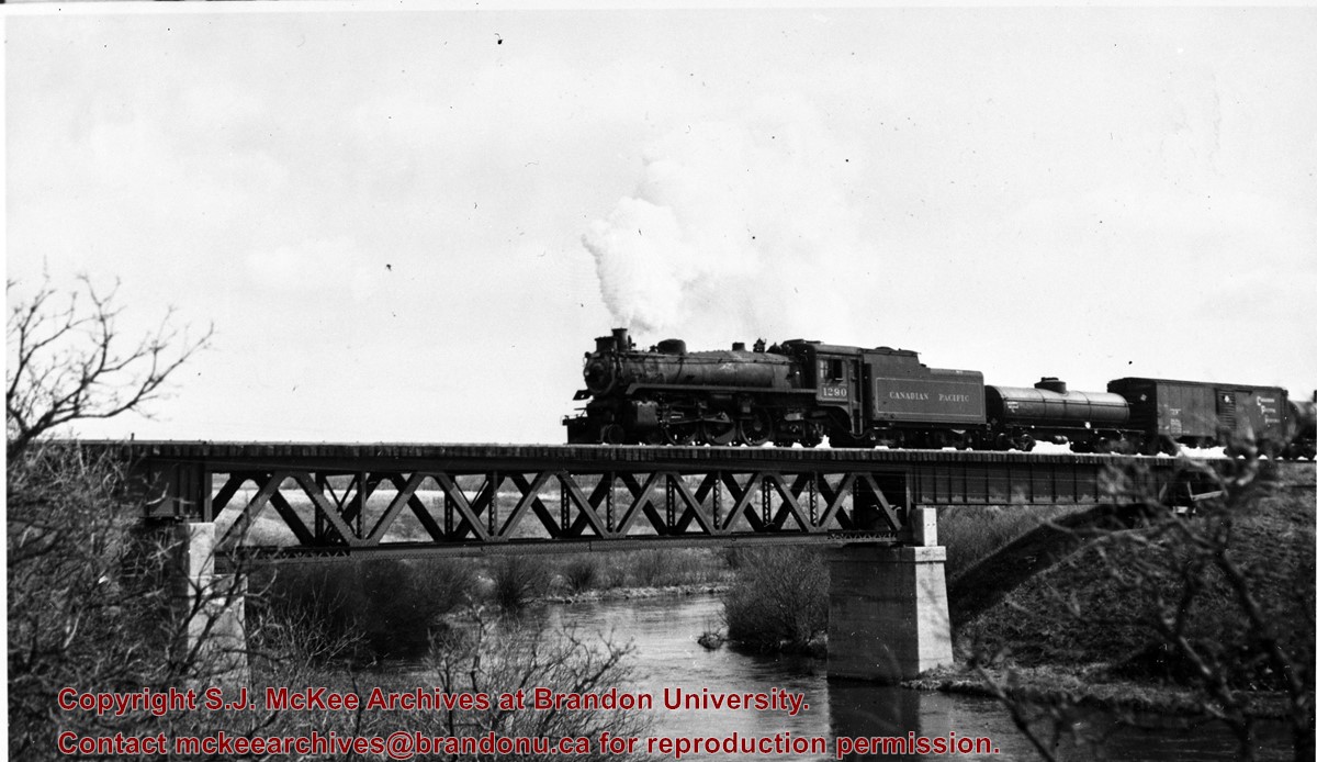
On 16 November 1906, Manitoba was hit by a severe winter storm that began that Thursday evening and extended through the weekend. The Brandon Daily Sun ("Storm Extends Over a Large Territory," 17 Nov. 1906, 1) reported that rail and telegraph services had been disrupted, country roads were impassable, and business in town was at a stand still. Following the weekend, the daily reported the blizzard was one of the greatest in recent memory. CPR trains had been caught in drifts by Carberry and an express car had caught fire and was destroyed ("Worst Storm in Many Years," Brandon Daily Sun, 19 Nov. 1906, 1).
Scope and Content
Photograph shows street view of intersection of the 000 block of 8th Street and Rosser Avenue in the winter. Businesses on the east side of 8th Street from Pacific to Rosser Avenues are clearly visible and include: a Lunch Room (likely Aagaard's Lunch Counter), the Hotel Imperial Annex, Liverpool House (a boarding house), R.S. Thompson and Company Real Estate Office (Land Office), a barber shop (likely J. Coulter's), Frank Gowen photography studio. Fleming's Drug Store on the corner of 8th Street and Rosser Avenue has been replaced by the Bank of Hamilton. The Imperial Hotel is visible on the west side of 8th Street. The 8th Street Bridge is visible in the background. Men in winter coats and hats are crossing the street at the intersection. A horse-drawn sleigh is parked on 8th Street.
Notes
Writing on the front of the photograph matting reads: 340, after the storm November 1906. Page appears to be from a photo album. The photograph appears to be taken from the interior of a builing on the southwest corner of 8th Street and Rosser Avenue.
Kirkham's Bridge was built in 1906, to replace an earlier wooden bridge. The bridge was used until 1981, when it was purchased by the Town of Birtle and moved to a newsite. A former railway pridge was installed in its place.
Scope and Content
Photograph shows Kirkham's Bridge, a steel truss bridge that spanned the Little Saskatchewan River in the Municipality of Riverdale.
Notes
Identification of the bridge provided by Ken Storie (2023). Additional information taken from the Manitoba Historical Society website.


+Railway+Bridge+at+Bunclody)