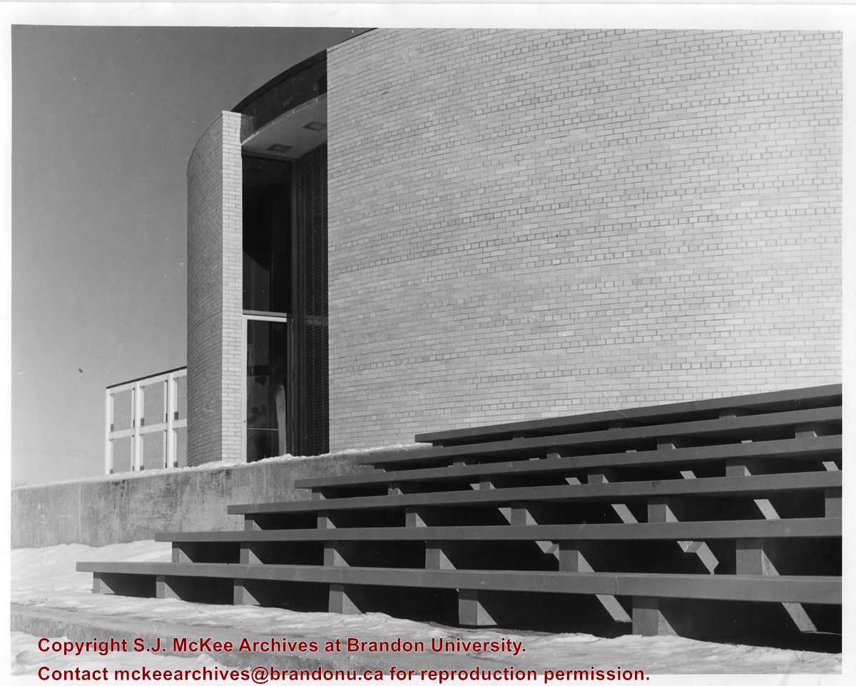
Photograph is looking west and shows where the J.R.C. Evans Lecture Theatre meets the link that joined it to the A.E. McKenzie Building. Photograph was taken in winter.
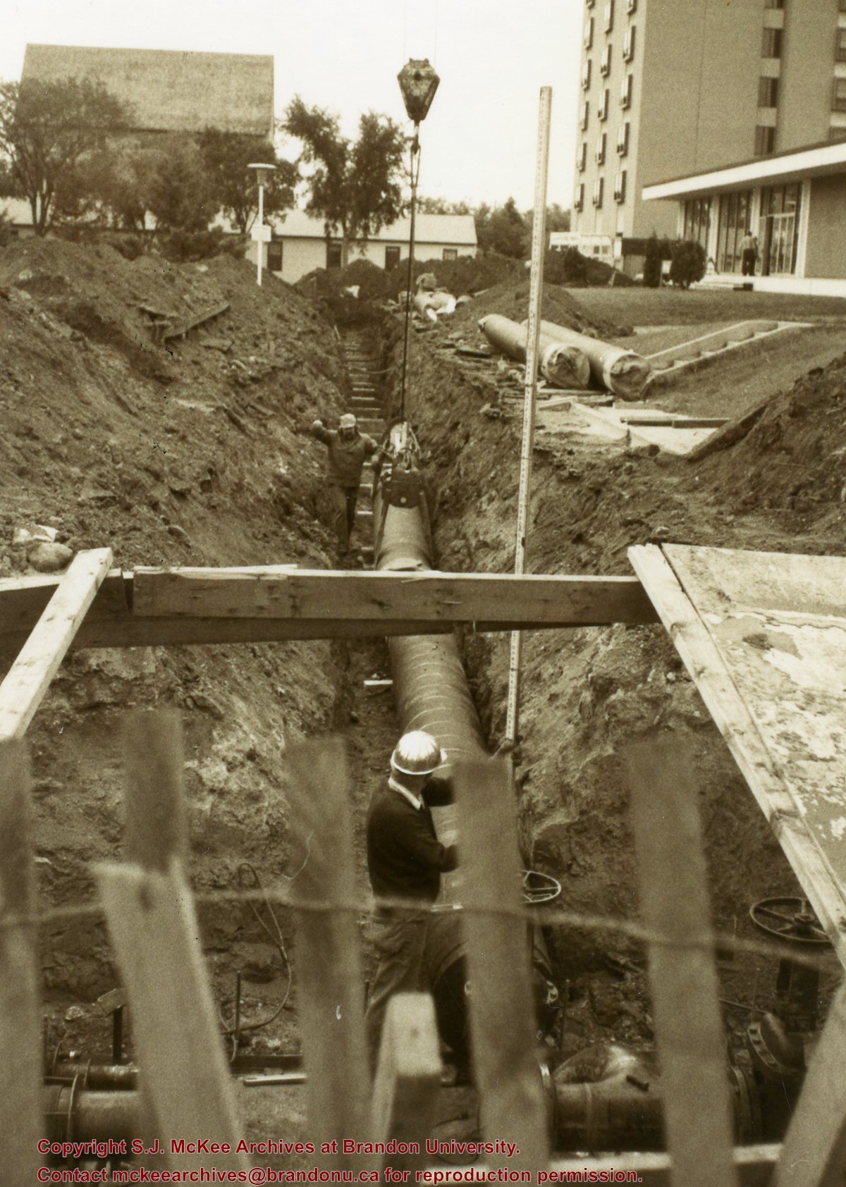
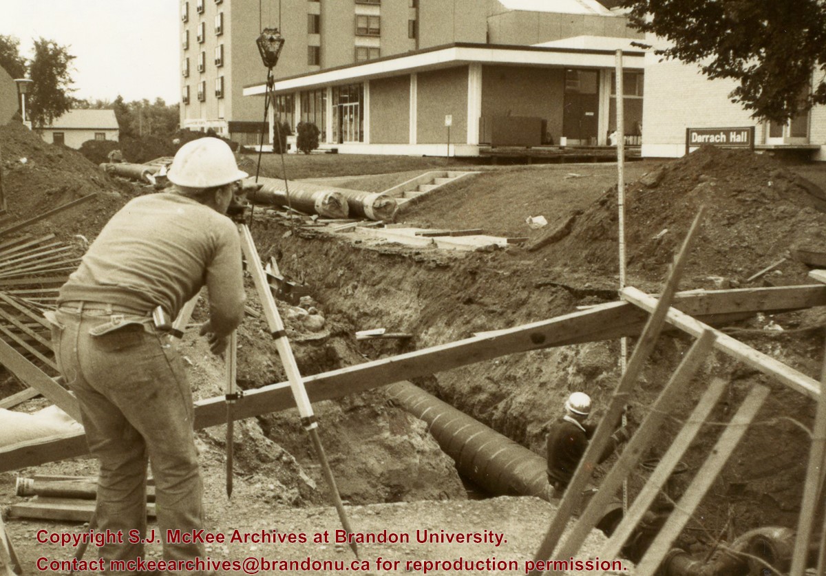
Photograph is looking southeast from 20th Street and shows the laying of pipes to the north of Darrach Hall and the Dining Hall as part of the Library extension. Photograph also shows a man surveying the site.
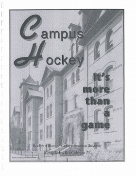
Mr. Coleman has given the S. J. Archives permission to place a pdf version of Campus Hockey online for use by patrons of the archives.
Physical Description
1 cm
Physical Condition
Excellent
History / Biographical
Ken Coleman was born in Virden, Manitoba and attended Brandon University from 1970 to 1975; he graduated with a B.A. in Economics and Geography in 1974 and then completed the professional year of teacher training. During his time at Brandon University he served as student manager of the Bobcat hockey team. Coleman was inducted into the Bobcat Hall of Fame in 1996.
From 1982-1985, Coleman taught in Birtle, Manitoba. He spent the next three years working for the Brandon Wheat Kings. From 1988 until his retirement in May 2006, he worked in the newspaper business.
At present (April 2007), Ken Coleman is single and continues to live in Brandon.
Custodial History
Records donated to the McKee Archives by Ken Coleman in 2002.
Scope and Content
Fonds consists of a copy of "Campus Hockey: It's more than a game" compiled by Ken Coleman, Class of 1974. The book contains players lists (with statistics) and team profiles for the Brandon College years (1909-10 to 1966-67) and players lists (with statistics), coaching records, team profiles, scoring champions, career scorers, career goaltenders and career scoring leaders for the Brandon University years (1967-68 to 2001-02). The book also includes lists for the Honour Roll (1956-57 to 2001-02), school awards (1952-53 to 2001-02) and the Bobcats Hall of Fame (1993-2000). Finally, the book contains black and white copied photographs of many of the teams.
Notes
History/Bio information provided by Ken Coleman (April 12, 2007).
Location Copy
Copies of the photographs used in Coleman's book have been scanned to network drive T under BUPC - Hockey.
View is southwest from approximatley 16th Street between Princess and Rosser Avenues. Photograph shows the Brandon University campus, as well as surrounding residential blocks, including Flemming, J.R. Reid and Vincent Massey schools.
View is west southwest from approximatley 16th Street between Princess and Lorne Avenues. Photograph shows the Brandon University campus, as well as surrounding residential blocks between 16th and 23rd Streets, Princess and Louise Avenues..
View is west from approximatley 17th Street between Lorne and Louise Avenues. Photograph shows a portion of the Brandon University campus (excluding the Education Building and anything north of it), as well as surrounding residential blocks from approximatley 17th Street to 22nd Street.
View is west northwest from approximatley 16th Street and Louise Avenue. Photograph shows the Brandon University campus, prior to the Library Extension, and a large portion of the city to the west of the campus.
View is northwest from approximatley 16th Street and Louise Avenue. Photograph shows the Brandon University campus, prior to the Library Extension, and a large portion of the city to the west of the campus.
Photograph shows the removal of one of the houses formerly located on 20th Street between Louise and Princess Avenues. The houses on those blocks were removed to create parking lots for the University. A Fed Zavislak Ltd. Well Drilling & Trucking pickup truck is visible at the curb.
Photograph shows the removal of one of the houses formerly located on 20th Street between Louise and Princess Avenues. The houses on those blocks were removed to create parking lots for the University.
Photograph shows a backhoe digging a sewer hole near the sidewalk between the Brandon College Building and the Citizens' Science Building. The Knowles-Douglas Students' Union Centre, John R. Brodie Science Centre and a portion of the driveway are visible in the background.
View is northwest from the roof of the John R. Brodie Science Centre. Photograph shows the roof of the Knowles Douglas Students' Union Centre, the Citizens' Science Building, and the Brandon College Building and Clark Hall during renovation.
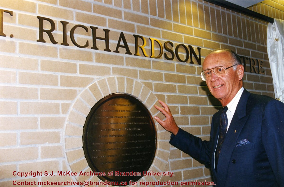
Photograph was taken from the roof of the Library and shows the walkway and flower bed on the southeast corner of the George T. Richardson Centre. The Physical Plant H-Hut is visible in the top right hand corner.
View is southwest from the roof of the George T. Richardson Centre. Photograph shows the curved glass wall of the John E. Robbins Library, the walkway between the Library and the Dining Hall, the Dining Hall and Darrach Hall.
View is north probably from the roof of McMaster Hall. Photograph shows the construction of the new roof on Clark Hall and the Brandon College Building.


