Image shows the Brandon College campus from 17th Street looking southwest. The photo was taken after the completion of the original Music Building in 1963, but construction of the Education Building. Also visible are a number of properties on the 200 block of 18th Street and the 200 block of 20th Street.
View is east northeast from approximately 22nd Street between Lorne and Louise Avenues. Photograph shows: Brandon College (before planting of trees in quadrangle and before the Education Building), McKenzie Seeds, Prince Edward Hotel, Central United (St. Paul's) Church, St. Augustine's Church.
View is east from approximatley 22nd Street between Lorne and Louise Avenues. Photograph shows: Darrach Hall, Flora Cowan Hall and the Citizens' Science Building, as well as a number of homes in the area.
Image is looking east northeast from approximately the 300 block of 23rd Street between Lorne and Louise Avenues. Photograph shows the Brandon College campus after the opening of the original Music Building in 1963, but before the construction of the Education Building in 1966. A number of house on the 300 blocks of 22nd and 21st Streets are visible in the foreground, with the A.E. McKenzie Seed Co., the Prince Edward Hotel and various grain elevators on the horizon.
View is north, taken from approximatley 19th Street and Rosser Avenue. Photograph shows: Clark Hall, the A.E. McKenzie Building, the J.R.C. Evans Lecture Theatre, H-Huts, Darrach Hall and Flora Cowan Hall, as well as a number of homes in the area.
View is northwest from approximately the corner of 18th Street and Louise Avenue. Photograph shows the Brandon College campus after the completion of Flora Cowan Hall.
Notes
BUPC 2.1.20 is a larger version of this photograph.
The bottom right hand corner has been torn off. Both portions of the photograph are stored together.
Scope and Content
View is northwest from approximately 17th Street and Victoria Avenue. Photograph shows: the Brandon College campus and the Kinsmen Park and baseball diamond. Taken during construction of Flora Cowan Hall but before the Gymnasium was built.
Photograph is looking northwest probably from the John R. Brodie Science Centre and shows the Citzens' Science Building, the Brandon College Building, Clark Hall and a portion of the driveway and grounds in front of the buildings.
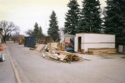
Image is looking north along the driveway in front of Clark Hall and the Brandon College Building, and shows building materials, equipment and debris. The photograph was taken during the renovations of the Brandon College Building and Clark Hall.
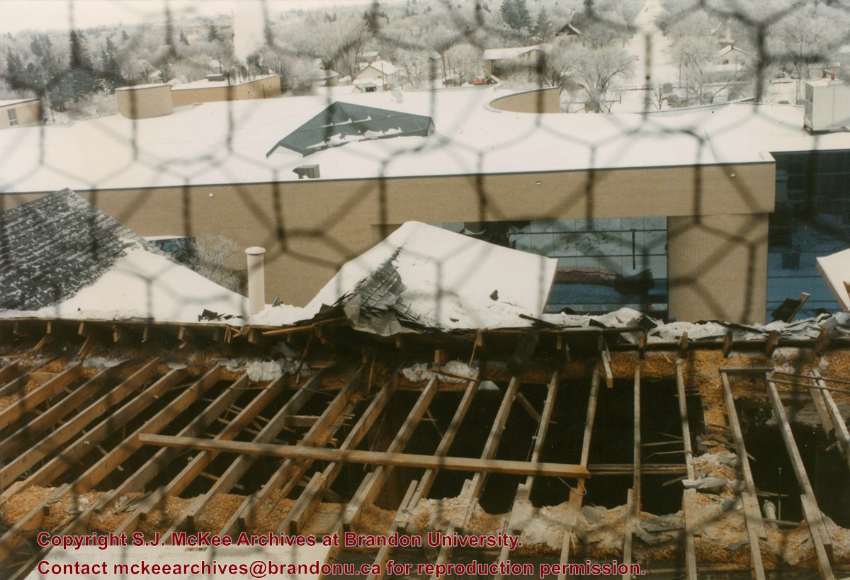
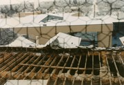
View is west from the roof of the Brandon College Building. Photograph was taken through wire fencing and shows roof beams during construction on the roof of the Brandon College Building during winter. Part of the George T. Richardson Centre and the second steam plant are visible in the background, as well as a few houses.
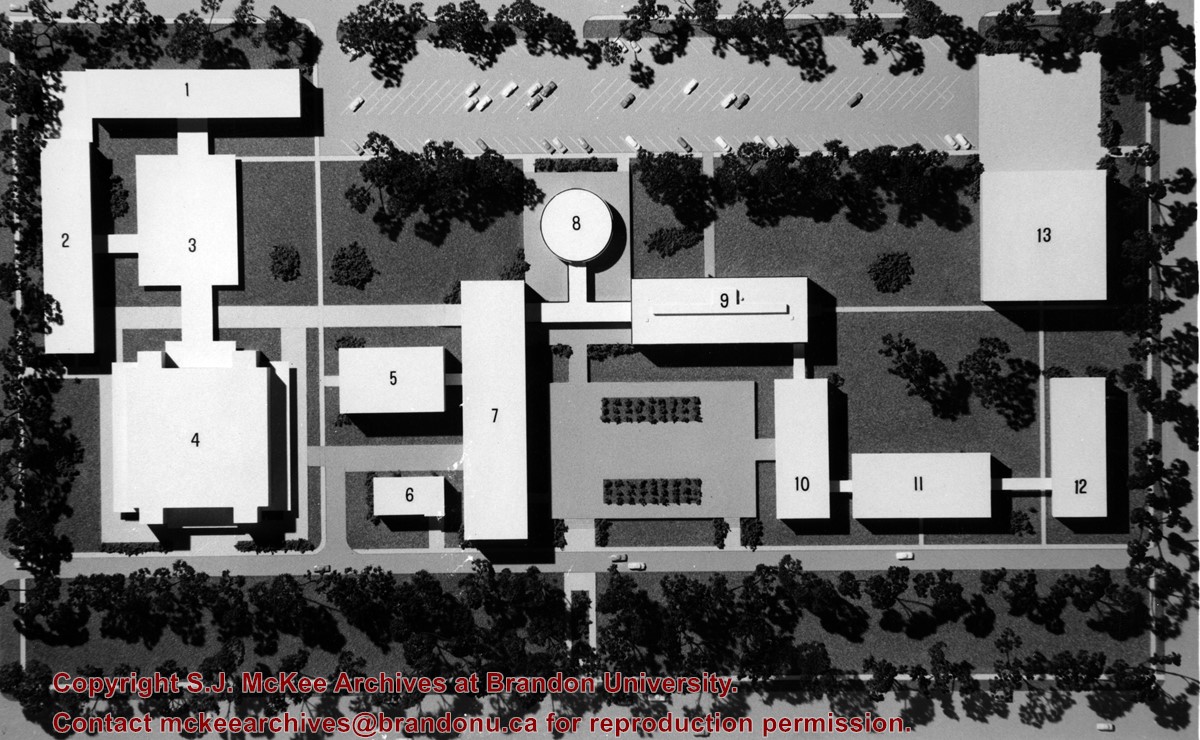
The idea behind the new proposed campus was to tear down the Brandon College Building and Clark Hall and either move the entire campus west on Victoria Avenue to land owned by Fotheringham or to rebuild the campus on the existing grounds.
Scope and Content
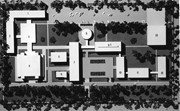
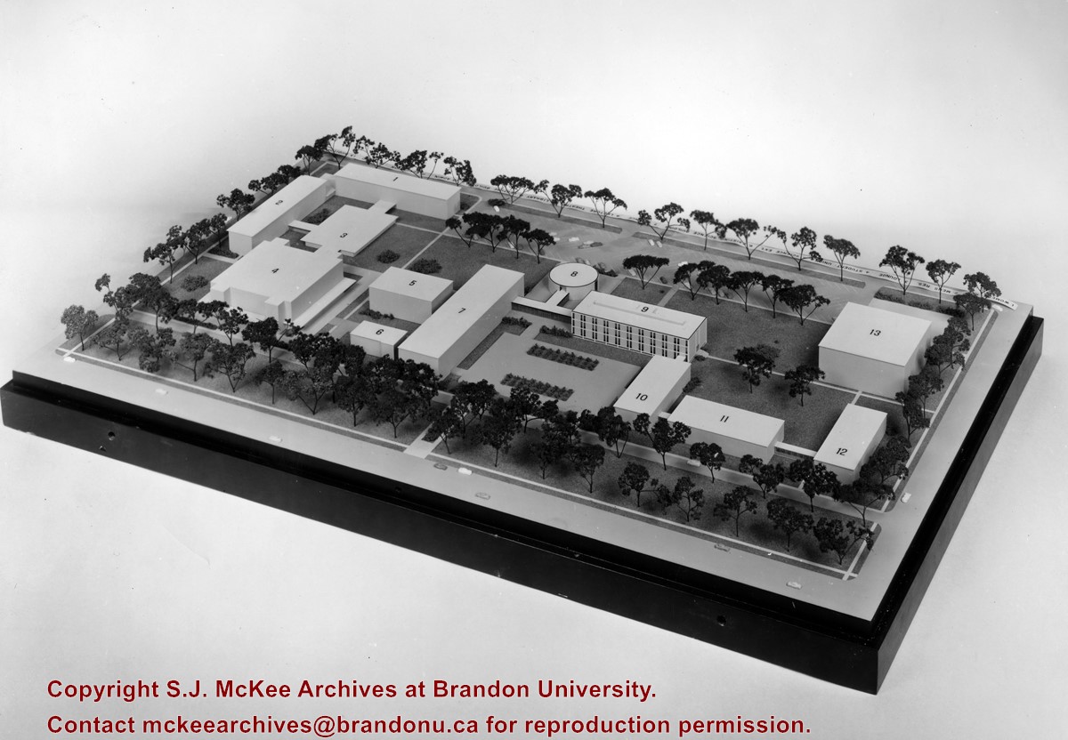
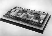
Photograph shows a model of a proposed new campus for Brandon University. In the model the Brandon College Building and Clark Hall have been removed.
The idea behind the new proposed campus was to tear down the Brandon College Building and Clark Hall and either move the entire campus west on Victoria Avenue to land owned by Fotheringham or to rebuild the campus on the existing grounds.
Scope and Content
Photograph shows a model of a proposed new campus for Brandon University. In the model the Brandon College Building and Clark Hall have been removed.
View is northwest from the roof of the Brandon College Building. Photograph was taken through wire fencing and shows construction on the roof of the Brandon College Building during winter. The original Clark Hall entrance to the roof is clearly visible. Portions of the A.E. McKenzie Building, Clark Hall and the Western Manitoba Centennial Auditorium are visible in the background.
View is northeast from the Brandon College Building. Photograph shows the inside of the Brandon College Building after it had been gutted and then partially rebuilt. The exterior fascade of the west side of the building can be clearly seen in this photograph. A number of houses on the east side of 200 block of 18th Street are also visible, as is the stone fence on Princess Avenue and the flag pole on the front lawn.
View is northeast. Photograph shows the green space before the Library extension in 1993. Brandon College Building and the Development H-Hut in the background.
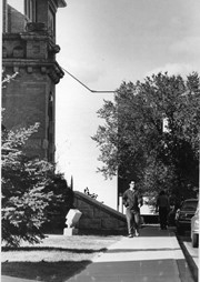
Photograph shows a student walking south along the sidewalk in front of Clark Hall and the Brandon College Building. Education Building in the background.
View is northeast from the Dining Hall. Photograph shows the greenspace, the J.R.C. Evans Lecture Theatre, the A.E. McKenzie Building, the Brandon College Building and Clark Hall.
View is southwest from the north side of Princess Avenue. Photograph shows the original Music Building, the north driveway entrance and parts of Clark Hall and the Brandon College building.
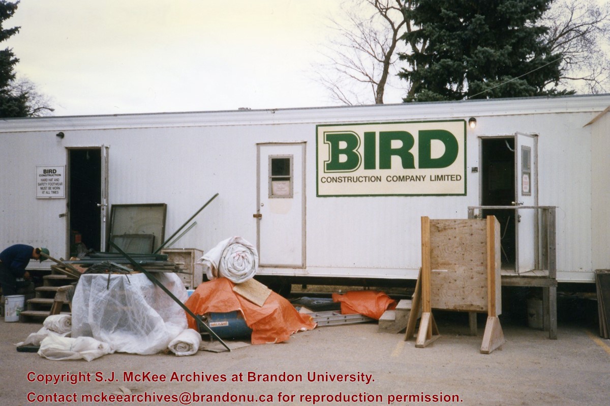
Photograph shows the Bird Construction Company Limited trailer located on the driveway of the Brandon University campus during the renovations to the Brandon College Building and Clark Hall.


