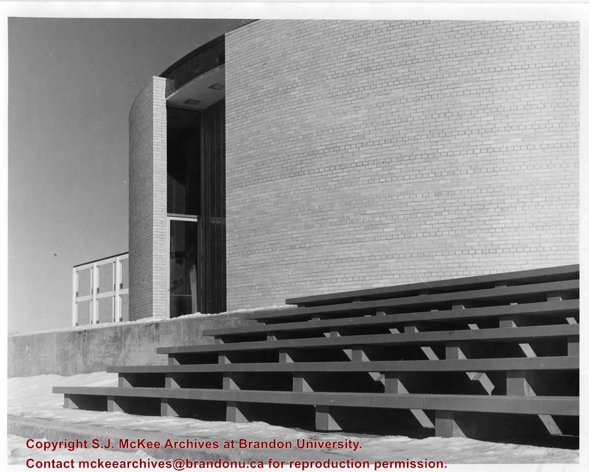
Photograph is looking northeast and shows the staircase at the rear of the J.R.C. Evans Lecture Theatre. Part of the A.E. McKenzie Building is visible in the background.
Photograph is looking west and shows where the J.R.C. Evans Lecture Theatre meets the link that joined it to the A.E. McKenzie Building. Photograph was taken in winter.
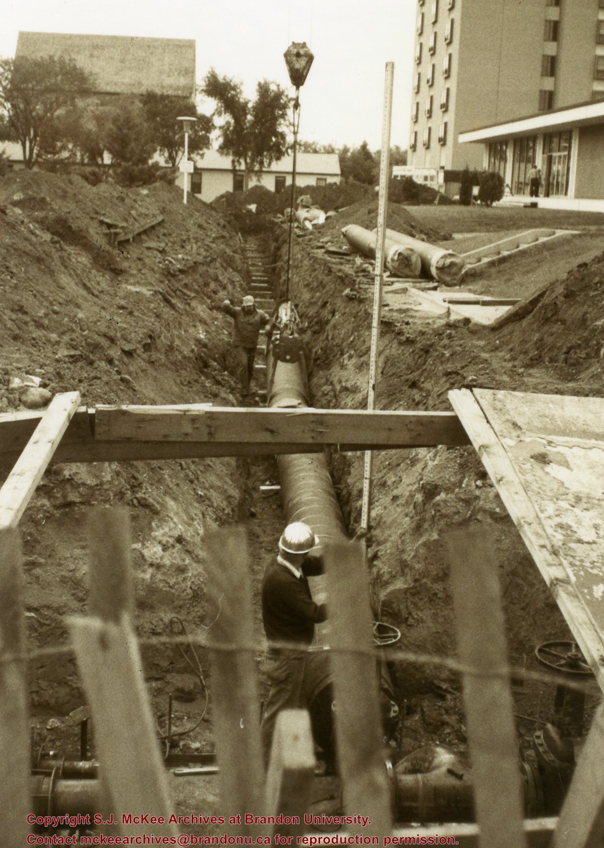
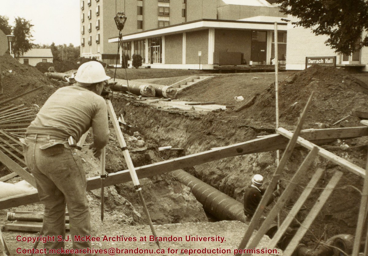
Photograph is looking southeast from 20th Street and shows the laying of pipes to the north of Darrach Hall and the Dining Hall as part of the Library extension. Photograph also shows a man surveying the site.
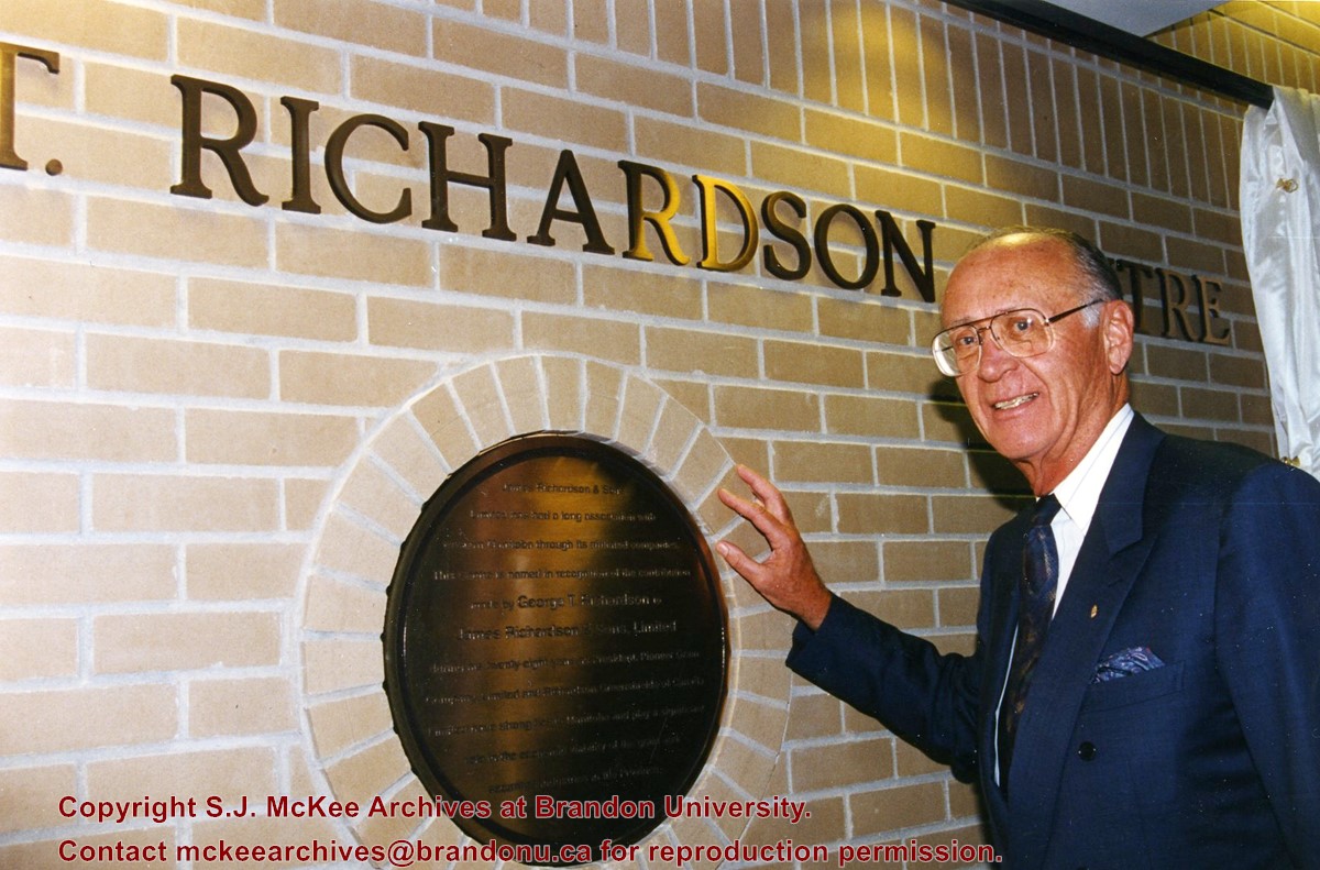
The J.R.C. Evans Lecture Theatre and the A.E. McKenzie Building were both completed in 1960. The Evans Theatre is named for John Robert Charles Evans, who served as president of Brandon College from 1928 to 1959. The A.E. McKenzie Building was originally the Library and Arts building, and was named for A.E. McKenzie, a local businessman and supporter of the College. The George T. Richardson Centre, which includes the Evans Theatre and the John E. Robbins Library, was completed in 1993.
Scope and Content
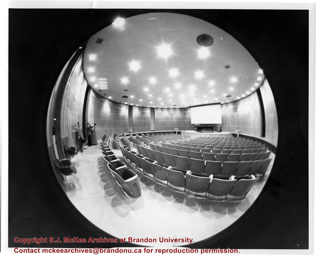
Sub-series consists of photographs of the A.E. McKenzie Building, the George T. Richardson Centre, the J.R.C. Evans Lecture Theatre, the John E. Robbins Library and the link between the Evans Theatre and the McKenzie Building.
View is southwest from approximatley 16th Street between Princess and Rosser Avenues. Photograph shows the Brandon University campus, as well as surrounding residential blocks, including Flemming, J.R. Reid and Vincent Massey schools.
View is west southwest from approximatley 16th Street between Princess and Lorne Avenues. Photograph shows the Brandon University campus, as well as surrounding residential blocks between 16th and 23rd Streets, Princess and Louise Avenues..
View is west from approximatley 17th Street between Lorne and Louise Avenues. Photograph shows a portion of the Brandon University campus (excluding the Education Building and anything north of it), as well as surrounding residential blocks from approximatley 17th Street to 22nd Street.
View is west northwest from approximatley 16th Street and Louise Avenue. Photograph shows the Brandon University campus, prior to the Library Extension, and a large portion of the city to the west of the campus.
View is northwest from approximatley 16th Street and Louise Avenue. Photograph shows the Brandon University campus, prior to the Library Extension, and a large portion of the city to the west of the campus.
Photograph shows the removal of one of the houses formerly located on 20th Street between Louise and Princess Avenues. The houses on those blocks were removed to create parking lots for the University. A Fed Zavislak Ltd. Well Drilling & Trucking pickup truck is visible at the curb.
Photograph shows the removal of one of the houses formerly located on 20th Street between Louise and Princess Avenues. The houses on those blocks were removed to create parking lots for the University.
Photograph shows a backhoe digging a sewer hole near the sidewalk between the Brandon College Building and the Citizens' Science Building. The Knowles-Douglas Students' Union Centre, John R. Brodie Science Centre and a portion of the driveway are visible in the background.
View is northwest from the roof of the John R. Brodie Science Centre. Photograph shows the roof of the Knowles Douglas Students' Union Centre, the Citizens' Science Building, and the Brandon College Building and Clark Hall during renovation.
Photograph was taken from the roof of the Library and shows the walkway and flower bed on the southeast corner of the George T. Richardson Centre. The Physical Plant H-Hut is visible in the top right hand corner.


