Postcard shows the 100 block of 10th Street facing north. The CPR train station can be seen at the end of 10th Street. The sign for the Rex Cafe is visible on the west side of 10th Street. On the east side of 10th Street, billboards for Campbell & Campbell furniture are visible as well as signs for Pianos and the Orpheum Theatre. Motorists and cyclists share the road. Street car tracks run the length of 10th Street.
Notes
Back of postcard reads: Morning reflection of Brandon's skyline on the Assiniboine River, photo by Sandy Black, printed in Brandno, Manitoba, Canada by Leech Printing Ltd.
Situated in the R.M. of Whitehead on the Little Saskatchewan River, the 10 Mile Dam was a 14 kilometer transmission line that supplied the city of Brandon with power. The Brandon Electric Light Company built the dam in 1900 and it is considered Manitoba's first hydroelectic power generating station. The dam spanned approximately 80 meters and was constructed from timber and reinforced with clay and stone. The station was decommissioned in 1924.
Scope and Content
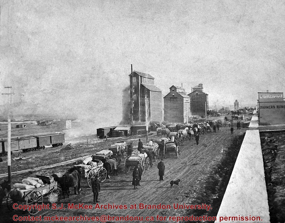
Photograph shows 10 Mile Dam, also known as the Brandon Dam or Minnedosa River Hydro Plant. The dam's timber construction is quite evident in the picture.
Notes
Writing on the back of the photograph reads: McGuinness (Manitoba Hydro), on Little Saskatchewan.
Kirkham's Bridge was built in 1906, to replace an earlier wooden bridge. The bridge was used until 1981, when it was purchased by the Town of Birtle and moved to a newsite. A former railway pridge was installed in its place.
Scope and Content
Photograph shows Kirkham's Bridge, a steel truss bridge that spanned the Little Saskatchewan River in the Municipality of Riverdale.
Notes
Identification of the bridge provided by Ken Storie (2023). Additional information taken from the Manitoba Historical Society website.
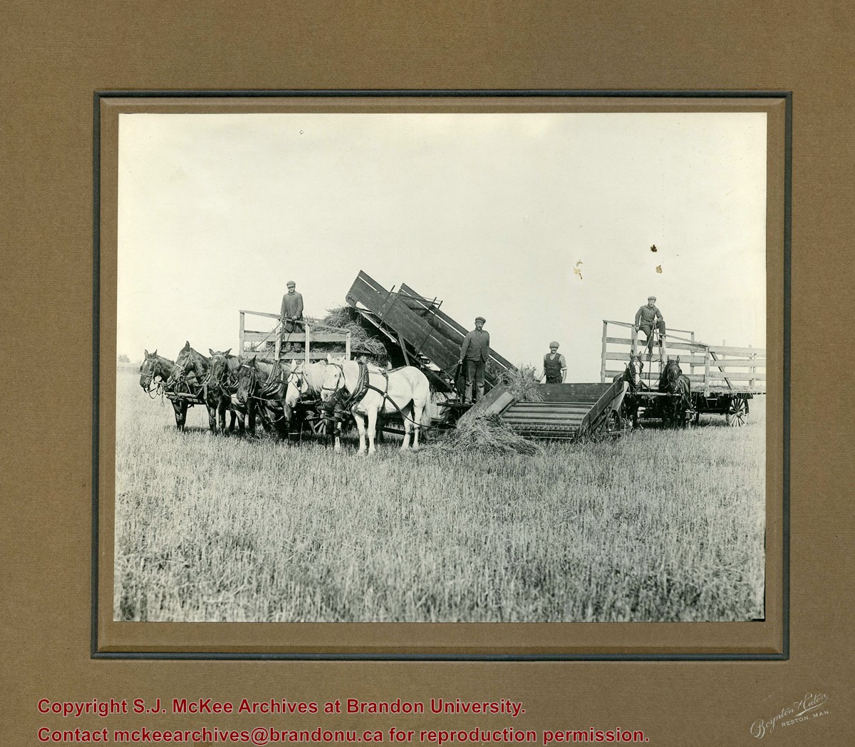
Postcard is of a combine bailing hay in the north end of Brandon at the junction of First Street and Veterans' Way. The Brandon city skyline is in the background and the orange Pioneer Grain elevator can be seen on the left side of the postcard.
Notes
Writing on the front of the postcard reads: Brandon, The Wheat City. Back of the postcard reads: Brandon the Agricultural and Industrial center for southwestern Manitoba; Photo by Sandy Black; Printed in Brandon, Manitoba, Canada, by Leech Printing Ltd.
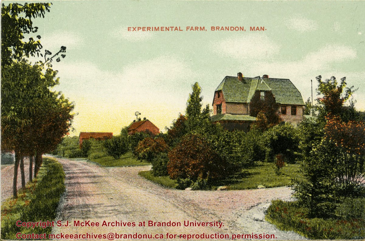
Photograph shows the buildings of the superintendant and barns of the Brandon Experimental Farm (now Brandon Rearch Station)
Notes
Part of "Christie's Brandon Series of Six Colored Picture Postcards of Brandon, Manitoba, The Crown Series, Published by Christie's Bookstore, Brandon, Man." [note: missing sixth postcard]. Writing on the front of the photograph reads: Experimental Farm, Brandon. Man.
Item is a portrait of men from the Rivers area who attended a meeting or workshop facilitated by Reg Forbes, Principal of the Agricultural Extension Centre in Brandon, MB. Some of the men in the photo are John Dick, Tommy Seens, Roy Murrey, Reed Spearn and Reg Forbes.
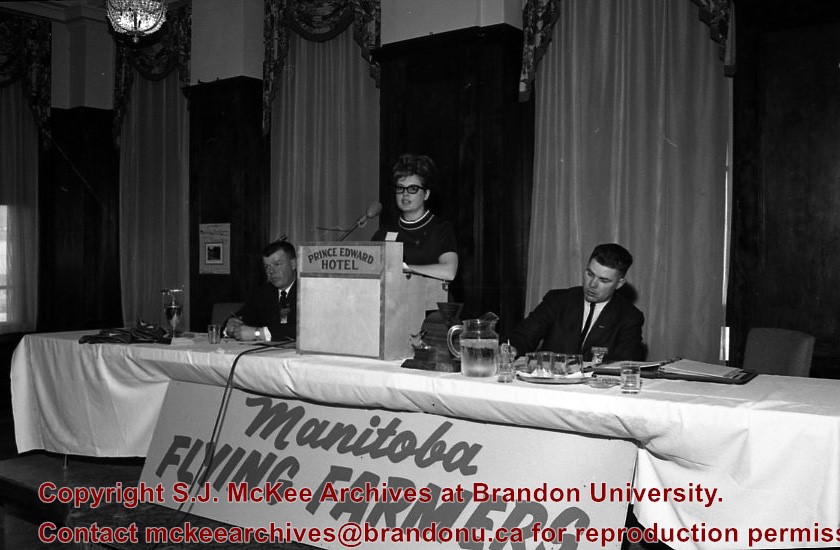
Manitoba Flying Farmers Convention appears to have been a convention for farmers who planted and sprayed their crops using aerial techniques. The Manitoba Flying Farmers were organized in 1956 in Brandon, Manitoba. Organizational meetings were held in a hanger at the Brandon Flying Club. The first Regional 5 Flying Farmers Convention in Manitoba was held 1961. Nearly 200 people attended the first convention from various provinces and states including: Alberta, Saskatchewan, North Dakota, South Dakota, Minnisota, Wisconsin, Montana and Colorado. Alberta and Saskatchewan had their own district leaving Manitoba in a district with North Dakota, South Dakota, Minnisota and Wisconsin. This photo was taken at the 11th Annual Manitoba Flying Farmers Convention on the weekend of April 7th, 1967.
Custodial History
See Fonds level description for custodial history
Scope and Content
Image of a woman presenting at the podium from the front table. Two men are sitting on either side of the woman. A sign saying "Manitoba Flying Farmers" is at the base of the table. The image appears to have been taken at the Prince Edward Hotel.
Notes
Hisotry/Bio information taken from Brandon Sun. Description by Jillian Combs.
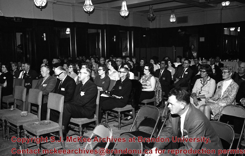
Manitoba Flying Farmers Convention appears to have been a convention for farmers who planted and sprayed their crops using aerial techniques. The Manitoba Flying Farmers were organized in 1956 in Brandon, Manitoba. Organizational meetings were held in a hanger at the Brandon Flying Club. The first Regional 5 Flying Farmers Convention in Manitoba was held 1961. Nearly 200 people attended the first convention from various provinces and states including: Alberta, Saskatchewan, North Dakota, South Dakota, Minnisota, Wisconsin, Montana and Colorado. Alberta and Saskatchewan had their own district leaving Manitoba in a district with North Dakota, South Dakota, Minnisota and Wisconsin. This photo was taken at the 11th Annual Manitoba Flying Farmers Convention on the weekend of April 7th, 1967.
Custodial History
See Fonds level description for custodial history
Scope and Content
Image of the attendants of the convention who are listening to the speaker. The image appears to have been taken in the Prince Edward Hotel.
Notes
Hisotry/Bio information taken from Henderson's Directories. Description by Jillian Combs.
Manitoba Flying Farmers Convention appears to have been a convention for farmers who planted and sprayed their crops using aerial techniques. The Manitoba Flying Farmers were organized in 1956 in Brandon, Manitoba. Organizational meetings were held in a hanger at the Brandon Flying Club. The first Regional 5 Flying Farmers Convention in Manitoba was held 1961. Nearly 200 people attended the first convention from various provinces and states including: Alberta, Saskatchewan, North Dakota, South Dakota, Minnisota, Wisconsin, Montana and Colorado. Alberta and Saskatchewan had their own district leaving Manitoba in a district with North Dakota, South Dakota, Minnisota and Wisconsin. This photo was taken at the 11th Annual Manitoba Flying Farmers Convention on the weekend of April 7th, 1967.
Custodial History
See Fonds level description for custodial history
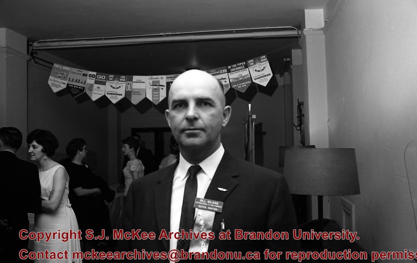
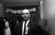
Scope and Content
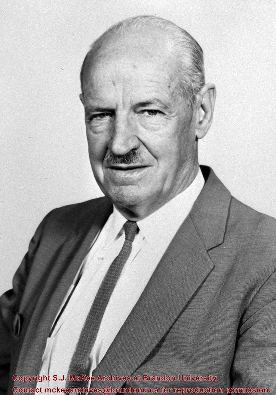
Image of convention attendee. Based on the name tag he appears to be Bill Williams (?). Image appears to have been taken inside the Prince Edward hotel. There is a banner in the background.
Manitoba Flying Farmers Convention appears to have been a convention for farmers who planted and sprayed their crops using aerial techniques.. The Manitoba Flying Farmers were organized in 1956 in Brandon, Manitoba. Organizational meetings were held in a hanger at the Brandon Flying Club. The first Regional 5 Flying Farmers Convention in Manitoba was held 1961. Nearly 200 people attended the first convention from various provinces and states including: Alberta, Saskatchewan, North Dakota, South Dakota, Minnisota, Wisconsin, Montana and Colorado. Alberta and Saskatchewan had their own district leaving Manitoba in a district with North Dakota, South Dakota, Minnisota and Wisconsin. This photo was taken at the 11th Annual Manitoba Flying Farmers Convention on the weekend of April 7th, 1967.
Custodial History
See Fonds level description for custodial history
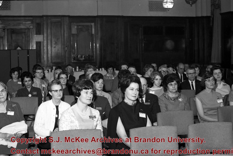
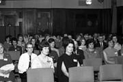
Scope and Content
Image of convention attendants listening to the speaker. There is a large number of women in the audience.The large number of women in the photo could be attributed to Flying Farmers queens of each distrcits encouragement of women learning to fly. The image appears to have been taken at the Prince Edward Hotel.
For history/bio information see the collection level description of the Lawrence Stuckey collection.
Custodial History
For custodial history see the collection level description of the Lawrence Stuckey collection.
Scope and Content
Series consists of slides created from photographs taken by Lawrence Stuckey during his travels throughout Manitoba, other parts of Canada and the United States. Although Lawrence and his wife Mavis travelled for pleasure, their destinations were often chosen deliberately to enable Lawrence to explore and photograph specific landscapes, flora and fauna.
The Snye was a former channel (oxbow lake) of the Assiniboine River. It was located south of the Assiniboine between about 14th and 24th Streets, and during high water in the spring it carried overflow. For many years it was used as a log storage area for Hanbury's Mill. I remember there being bridges over it at 18th & 22nd Streets. It was dammed with a one way flipper valve at 14th Street that allowed water to flow out to the river, but prevented river water backing into it. Water within the Snye became stagnant in summer and formed a breeding area for mosquitoes. It was deemed a health hazard and the river was gradually filled in. LAS.
Custodial History
For custodial history see the collection level description of the Lawrence Stuckey collection.
Scope and Content
Snye River
Notes
[This negative was produced using a previous published image. P.E. 22/07/09]
Additional historical information provided by the Fred McGuinness collection (20-2009).


