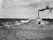
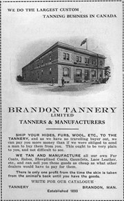
Brandon Sand & Brick Co. was better known as "Samson's Brick" for owner-proprietor Samson.
Plant located at 29th Street & Princess Avenue; Offices located in Smith Block.
Used Huennekes (German) system, whereby dried sand was mixed and ground with lime in a tube mill as water was added to slake the lime. The mixture was formed into bricks in a press, then steamed in a cylinder 6 ft. in diameter and 62 ft. long for 10 hours, under pressure of 120 psi, to form a compound like cement. Bricks were ready for use when taken from cylinder. (Ritchie, T. Canada Builds. pp. 219)
In addition to the Belvedere Apartments, many houses are faced with this brick. The rear of the 9th St. MTS building and others downtown buildings were also formed of it. Also used in interior walls of Prince Edward Hotel, Alexander School and many other buildings that were faced with more expensive brick. The product was so good, the plant's demise was likely caused by the post-WWI depression.(LAS)
Custodial History
For custodial history see the collection level description of the Lawrence Stuckey collection.
Scope and Content
Brandon Sand & Brick Co. (Samson's Brick)
Notes
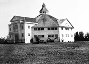
Great Northern Railway enginehouse visible in background [Fred McGuinness collection (20-2009)].
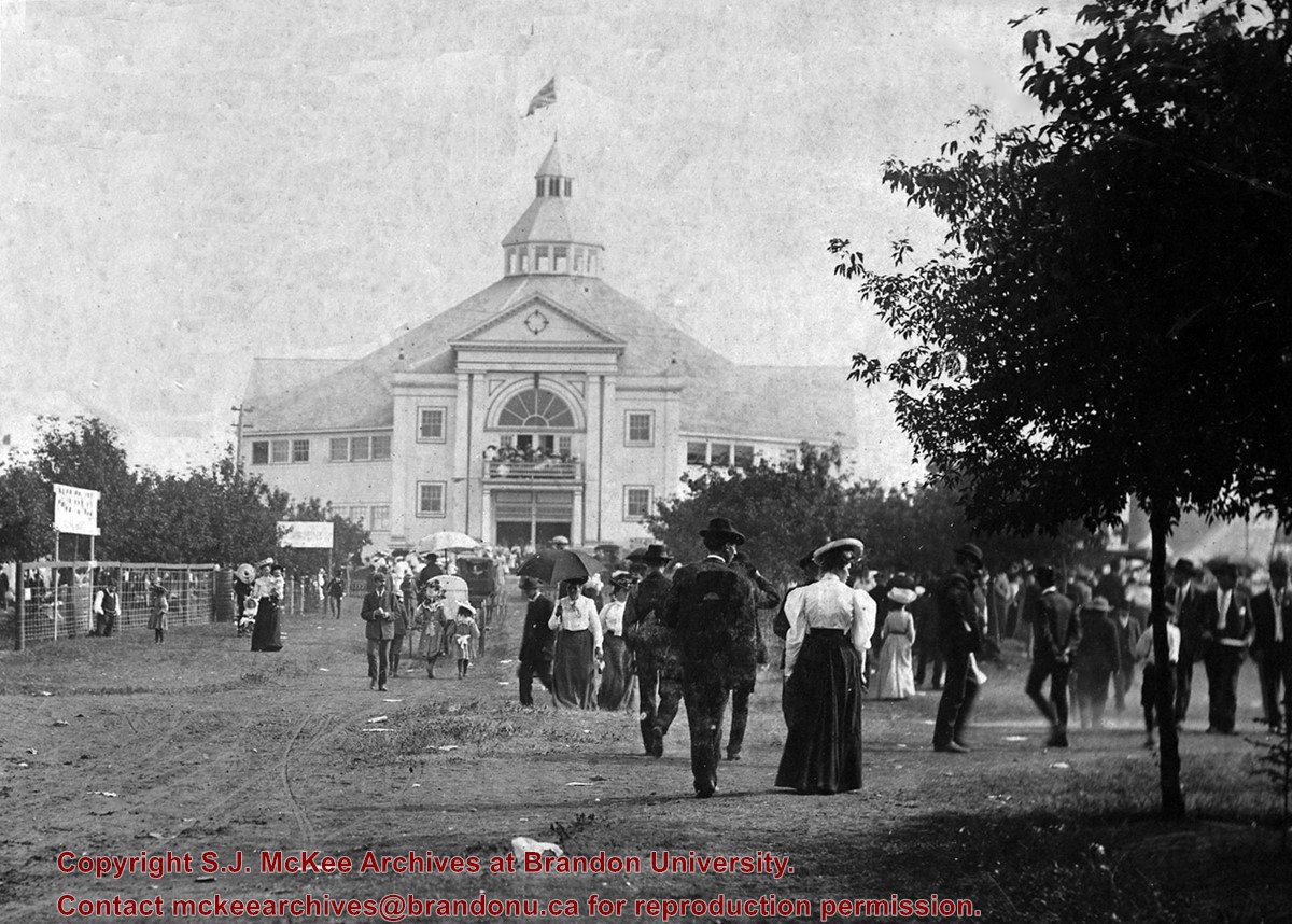
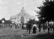
The Crystal Palace was built in 1904 ((Nor'West Farmer 20/08/1904); "Finishing touches" applied 1913 (Barker, p. 154); Demolished, but material saved, in 1939.
Custodial History
For custodial history see the collection level description of the Lawrence Stuckey collection.
Scope and Content
Front view of the Crystal Palace at Brandon fairgrounds
The Crystal Palace was built in 1904 ((Nor'West Farmer 20/08/1904); "Finishing touches" applied 1913 (Barker, p. 154); Demolished, but material saved, in 1939.
Custodial History
For custodial history see the collection level description of the Lawrence Stuckey collection.
Scope and Content
View of Crystal Palace at Brandon fairgrounds
Notes
[Images M28 and M29 are both on one 3 1/2" x 5" negative.]
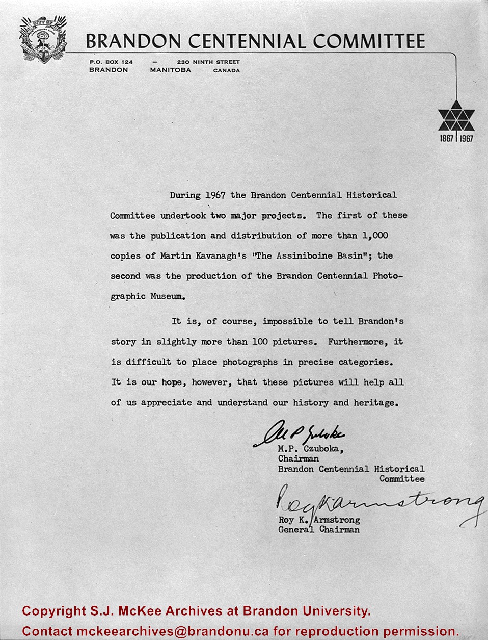
Contract for producing and framing 100 historical photos was awarded to myself as proprietor Clark Smith Studio. This gallery of photos is displayed in Neelin High School. LAS.
Custodial History
For custodial history see the collection level description of the Lawrence Stuckey collection.
Scope and Content
Letter outlining projects of National Centennial Committee of Brandon.
For custodial history see the collection level description of the Lawrence Stuckey collection.
Scope and Content
Brandon House No. 2 Cairn
Notes
[Cairn reads: "Brandon House No. 2 established on this site 10 A.M. Oct. 7 1828 by Chief Trader Francis Heron of the H.B. Co.; Abandoned 1832; This cairn Dedicated Oct. 7 1928; Erected by The Brandon Rotary Club" (P.E. 23/07/09).]
For custodial history see the collection level description of the Lawrence Stuckey collection.
Scope and Content
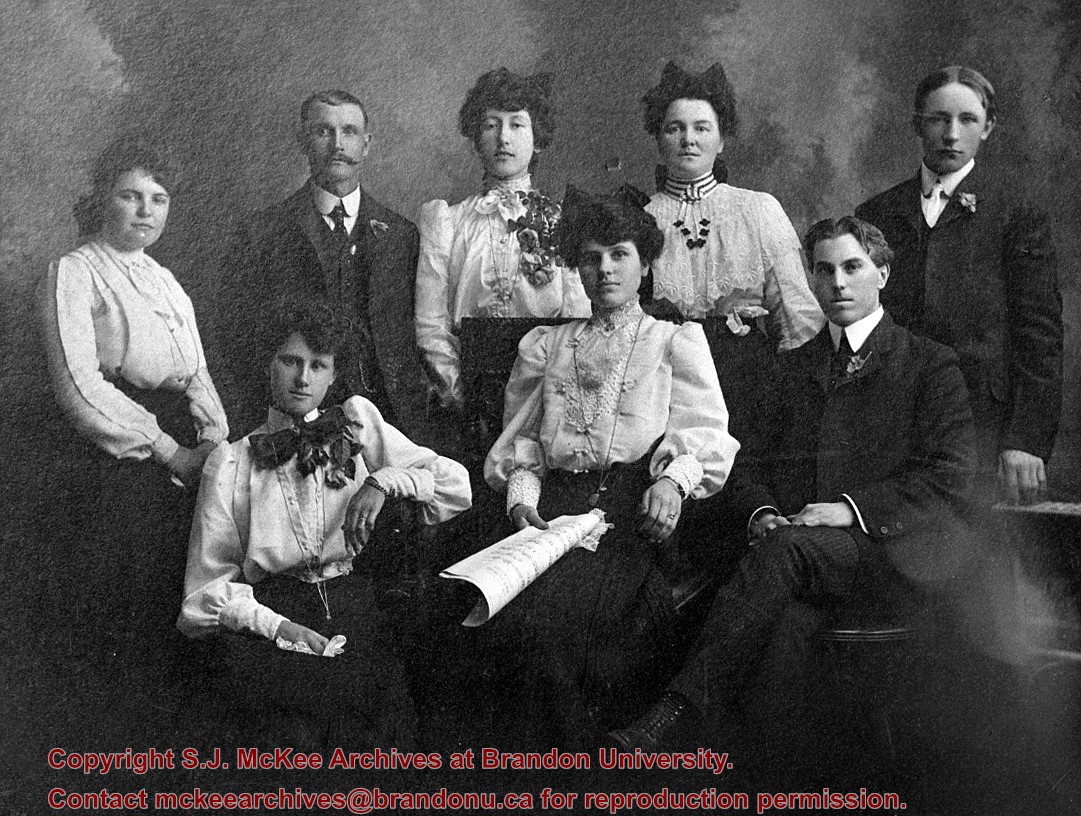
Brandon Hills Church Choir
Notes
Left to right. Back row: Mrs. Alden Blight, Wes. Stewart, Bessie Waugh (nee Roddick, later Chapman), Mary Baker, Alden Blight. Front row: Rachael Baker, Aletha Blight, Mr. Waugh.
For custodial history see the collection level description of the Lawrence Stuckey collection.
Scope and Content
Interior of Brandon Hills Church
Notes
[Mr. Stuckey had taped a print to the outside of the envelope. We have separated the negative and the print, numbering them OA7(1) and OA7(1a) respectively.]
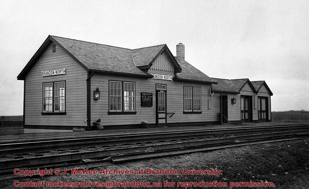
[This station, located 13 km north of Brandon on the east side of PTH 10, was] built in the early 1930s to replace Knox as the CNR’s mainline station for Brandon. All passenger trains stopped and buses operated between the CNR’s Brandon station and Brandon North to meet all trains. It was enlarged as shown here in late 1930s, and at peak operation in the 1940s & 1950s saw six daily passenger trains 1 - 2 & 3 - 4 “Continental Limited” and 11 - 12 locals. VIA trains 3 and 4 "Supercontinental" ceased operation Nov. 15, 1981 leaving no passenger service on the former Grand Trunk Pacific mainline of CNR [at that time]. This station was demolished in the fall of 1982.
Custodial History
For custodial history see the collection level description of the Lawrence Stuckey collection.
According to Stuckey and Bain (1996), “The Brandon, Saskatchewan & Hudson’s Bay Railway was built and operated as a totally owned subsidiary of the Great Northern Railway. Construction commenced in late 1905 and by the end of 1905, less than a mile of track had been laid north of the boundary at St. John. In 1906, the remaining 68.6 miles to Brandon were laid and service commenced that year. During the Depression of the 1930s, traffic declined significantly and the entire branch was abandoned in 1936. Over much of the branch’s length, the ties and rails were laid on the prairie without ballast and today little remains of the line apart from traces where there were cuts and bridges.” (p. 18)
Stuckey, L. A., & Bain, D. M. (1996). The Great Northern and Northern Pacific railways in Canada. Calgary, Alberta: British Railway Modellers of North America.
Custodial History
For custodial history see the collection level description of the Lawrence Stuckey collection.
Scope and Content
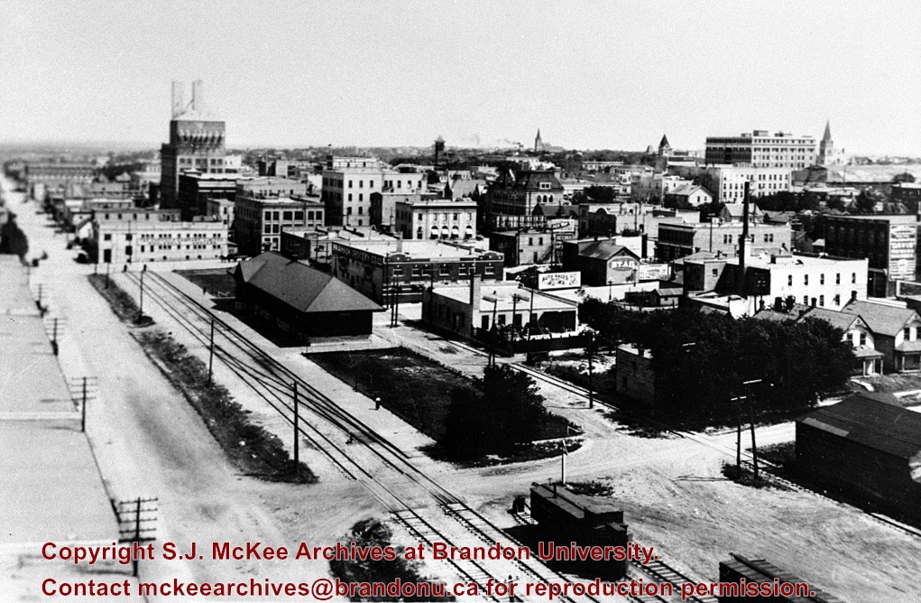
View of the Great Northern Railway's station in Brandon, Manitoba.
Notes
[Looking southeast; Pacific Avenue was located directly north (left) of the station and tracks. P.E. 30/07/09]
For custodial history see the collection level description of the Lawrence Stuckey collection.
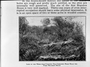
Scope and Content
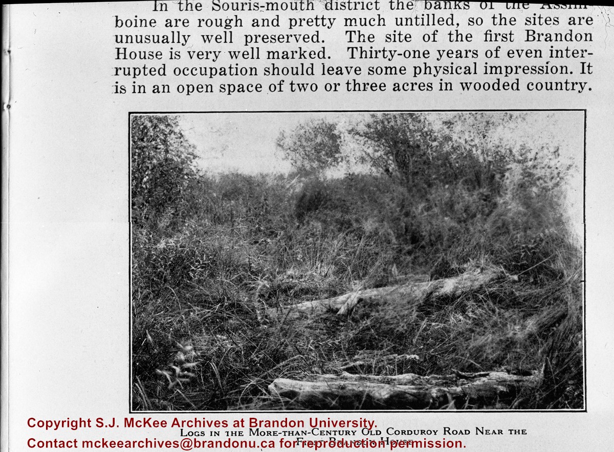
Image of corduroy road, Brandon House.
Notes
[Brandon SE includes communities south of Trans-Canada #1 highway and east of PTH #10.] [Caption on the image itself reads: "Logs in the more-than-century old corduroy road near the first Brandon House"]. [Additional information on the image itself reads: "In the Souris-mouth district the banks of the Assiniboine are rough and pretty much untilled, so the sites are unusually well preserved. The site of the first Brandon House is very well marked. Thirty-one years of even interrupted occupation should leave some physical impression. It is in an open space of two or three acres in wooded country."]
[Mr. Stuckey put two negatives in the same envelope and taped two prints to the outside . We have separated them and numbered the negatives (360a) and (360b) and the prints (360a-p) and (360b-p)].


.jpg?width=1200&404=no-img.jpg&watermark=wmk)
.jpg?width=180&404=no-img.jpg)
.jpg?width=1200&404=no-img.jpg&watermark=wmk)
.jpg?width=180&404=no-img.jpg)
.jpg?width=1200&404=no-img.jpg&watermark=wmk)
.jpg?width=180&404=no-img.jpg)
.jpg?width=1200&404=no-img.jpg&watermark=wmk)
.jpg?width=180&404=no-img.jpg)


.jpg%3fmaxheight%3d1000%26maxwidth%3d1000%26watermark%3dwmk&description=Brandon+House+No.+2+Cairn)
.jpg%3fmaxheight%3d1000%26maxwidth%3d1000%26watermark%3dwmk&description=Brandon+House+No.+2+Cairn)
.jpg%3fmaxheight%3d1000%26maxwidth%3d1000%26watermark%3dwmk&description=Brandon+Hills+Church+-+Interior)
.jpg%3fmaxheight%3d1000%26maxwidth%3d1000%26watermark%3dwmk&description=Brandon+Hills+Church+-+Interior)