View is northeast from approximately the southwest corner of Victoria Avenue and 22nd Street to the Assiniboine River near 1st Street. Photograph shows the College campus, Kinsmen Stadium, residential blocks, downtown and the railway tracks.
View is southeast from north of the corner of Princess Avenue and 22nd Street to approximatley Brandon Avenue. Photograph shows the University campus, Kinsmen Stadium, Earl Oxford School, and residential blocks. Brandon Collegiate Institute (BCI) is visible in the upper left corner.
View is west southwest from approximatley the northside of Princess Avenue just east of 18th Street. Photograph shows the University campus, part of Kinsmen Stadium and residential blocks.
View is northwest from approximatley the southeast corner of 18th Street and Louise Avenue. Photograph shows the University campus and residential blocks.
View is southwest from approximatley the corner of 17th Street and Princess Avenue to McDiarmid Drive. Photograph shows the Brandon University campus, Kinsmen Stadium, Fleming School, Coronation Park and residential blocks.
View is west northwest from aproximatley 15th Street and Louise Avenue to 34th Street. Photograph shows the Brandon University campus, part of Kinsmen Stadium, Fleming School, Coronoation Park, Valleyview Centennial School, Sacred Heart School ?, and residential blocks.
View is west northwest from aproximatley 16th Street and Louise Avenue to west of 34th Street. Photograph shows the Brandon University campus, part of Kinsmen Stadium, Coronoation Park, Valleyview Centennial School, part of the Assiniboine River and residential blocks.
View is northwest from the 400 block of 18th Street to the corner of 23rd Street and Rosser Avenue. Photograph shows the Brandon College campus (Flora Cowan Hall under construction) and residential blocks.
View is southwest from approximatley 16th Street and Princess Avenue to McDiarmid Drive. Photograph shows the Brandon University campus, Kinsmen Stadium, Fleming School, Coronation Park, J.R. Ried School and residential blocks.
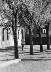
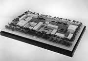
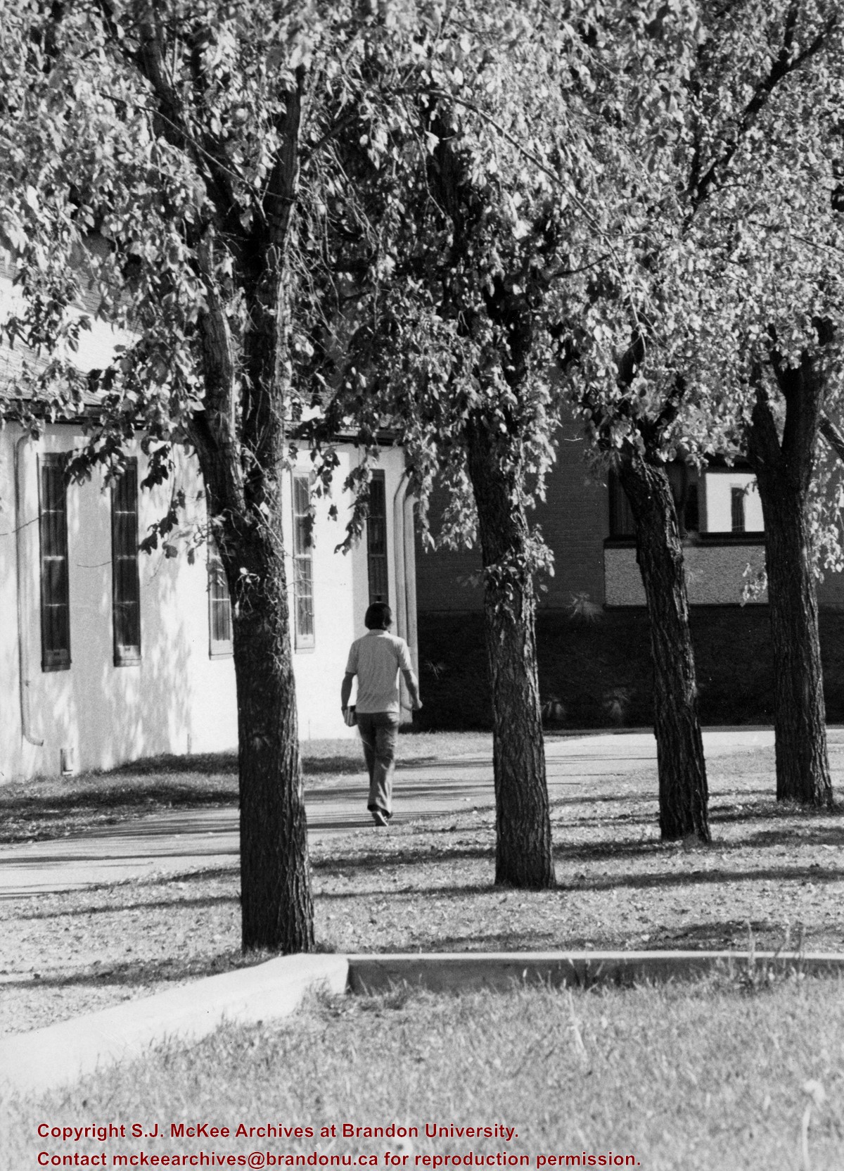
Photograph shows a student walking south along the sidewalk in front of Clark Hall and the Brandon College Building. Education Building in the background.
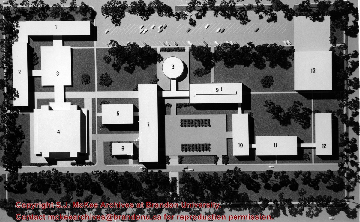
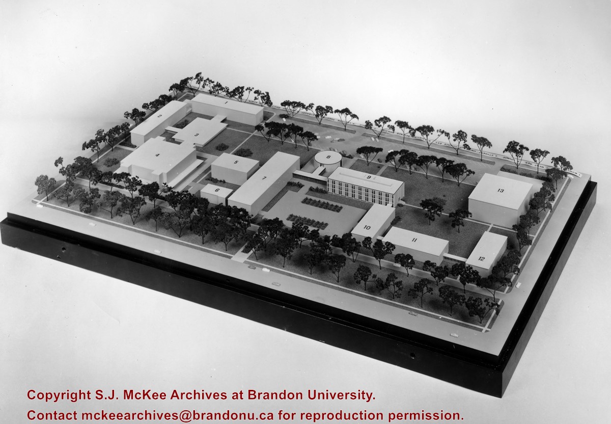
The idea behind the new proposed campus was to tear down the Brandon College Building and Clark Hall and either move the entire campus west on Victoria Avenue to land owned by Fotheringham or to rebuild the campus on the existing grounds.
Scope and Content
Photograph shows a model of a proposed new campus for Brandon University. In the model the Brandon College Building and Clark Hall have been removed.
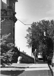
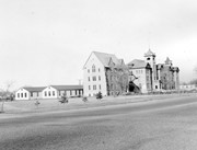
View is southwest from the north side of Princess Avenue. Photograph shows the north driveway entrance on campus. The original Music Building, the A.E. McKenzie Building, Clark Hall and part of the Brandon College Building are visible.
View is north from in front of the John R. Brodie Science Centre. Photograph shows the entrance to McMaster Hall, the Citizens' Science Building and an H-Hut, as well as the walkway between the buildings.
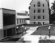
View is northwest from in front of the John R. Brodie Science Centre. Photograph shows the entrance to McMaster Hall and an H-Hut, as well as the flower beds in front of the Brodie Science Centre.
View is northwest from the southeast corner of 18th Street and Louise Avenue. Photograph shows the Citizens' Science Building, the Brandon College Building, Clark Hall and two H-Huts, as well as the land to the south of the buildings. The Original Music Building is partially visible in the background.
One small hole, some pencil marks and stains. A couple of the names are illegible.
History / Biographical
The Brandon Normal School was an arm of the provincial Department of Education. Manitoba Normal schools were initiated in the early 1880s (1882 for protestant teachers and 1883 for Roman Catholic ones) to meet the demand for teachers in the province's schools. Normal schools were held in Brandon at various locations until the construction of the Brandon Normal School in 1912 under the Roblin government. The Brandon Normal School operated until 1946.
Custodial History
Photograph was donated to the McKee Archives by Janette Donnelly in 1999.
Scope and Content
Portraits of the students and staff of Brandon Normal School's third class spring term (1921).


