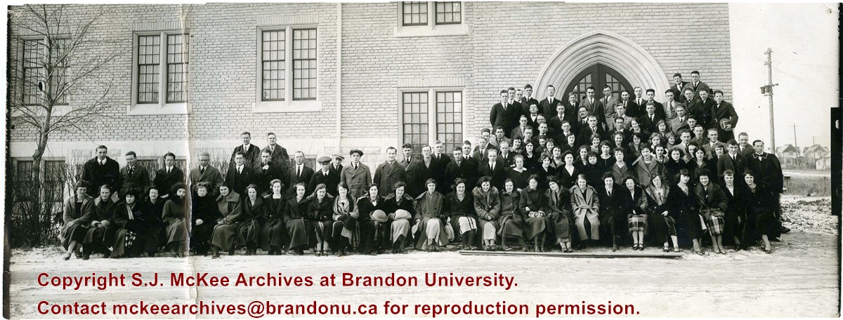
Prairie agriculture : containing a list of chemical experiments, a series of experiments on the growth of seeds, a decription of how plants grow, a sketch of the formation of the prairie soil by water and ice action, an account of farming operations and of crops adapted to Manitoba, a description of diseases of crops, of insects, and of birds, an account with illustrations of the breeds of horses, cattle, sheep, swine and poultry adapted to Manitoba, advantages of mixed farming
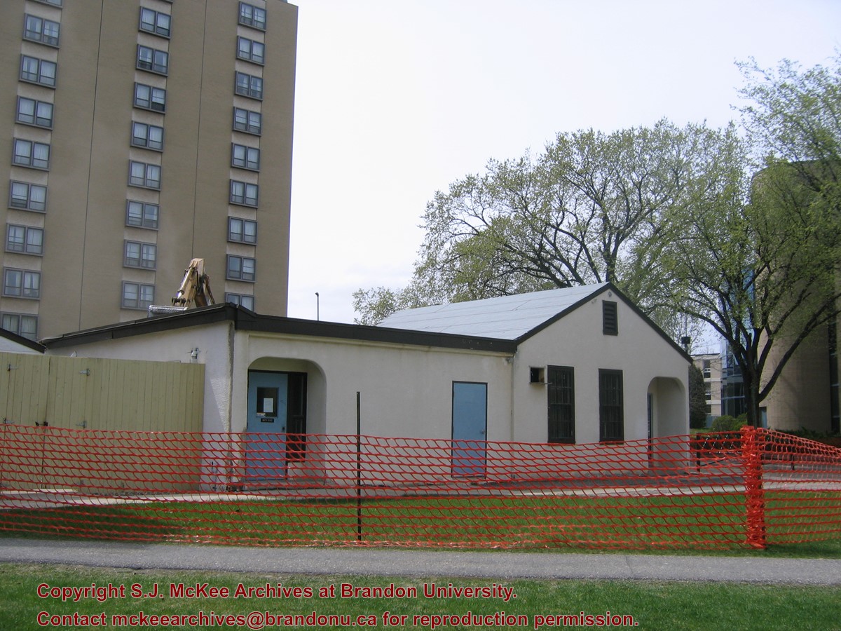
Located at the centre of the Brandon University campus, the Physical Plant H-Hut was destroyed following the opening of the new $3.9M, 13,600 square-foot physical plant on 07 April 2010.
Custodial History
Photograph was taken by McKee Archives project archivist Jill Sutherland.
Scope and Content
Photograph shows the demolition of the Physical Plant H-Hut.
Located at the centre of the Brandon University campus, the Physical Plant H-Hut was destroyed following the opening of the new $3.9M, 13,600 square-foot physical plant on 07 April 2010.
Custodial History
Photograph was taken by McKee Archives project archivist Jill Sutherland.
Scope and Content
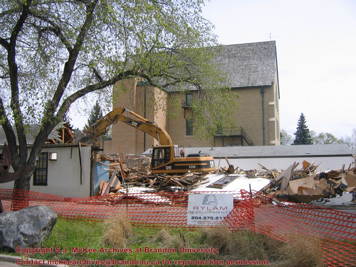
Photograph shows the demolition of the Physical Plant H-Hut. A sign for Rylam Development is visible on the snow fence fencing off the demolition site.
Located at the centre of the Brandon University campus, the Physical Plant H-Hut was destroyed following the opening of the new $3.9M, 13,600 square-foot physical plant on 07 April 2010.
Custodial History
Photograph was taken by McKee Archives project archivist Jill Sutherland.
Scope and Content
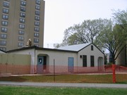
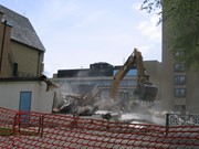
Photograph shows the demolition of the Physical Plant H-Hut. The photograph is looking northeast from the steps of Harvest Hall. The Citizens' Science Centre (BUSU Building) is visible in the background.
Located at the centre of the Brandon University campus, the Physical Plant H-Hut was destroyed following the opening of the new $3.9M, 13,600 square-foot physical plant on 07 April 2010.
Custodial History
Photograph was taken by McKee Archives project archivist Jill Sutherland.
Scope and Content
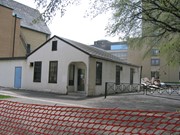
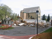
Photograph shows the demolition of the Physical Plant H-Hut. The photograph is looking northeast.
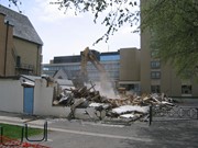
Located at the centre of the Brandon University campus, the Physical Plant H-Hut was destroyed following the opening of the new $3.9M, 13,600 square-foot physical plant on 07 April 2010.
Custodial History
Photograph was taken by McKee Archives project archivist Jill Sutherland.
Scope and Content
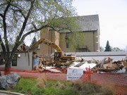
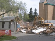
Photograph shows the demolition of the Physical Plant H-Hut. The photograph is looking south/southeast.
Located at the centre of the Brandon University campus, the Physical Plant H-Hut was destroyed following the opening of the new $3.9M, 13,600 square-foot physical plant on 07 April 2010.
Custodial History
Photograph was taken by McKee Archives project archivist Jill Sutherland.
Scope and Content
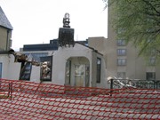
Photograph shows the demolition of the Physical Plant H-Hut. The photograph is looking south/southeast.
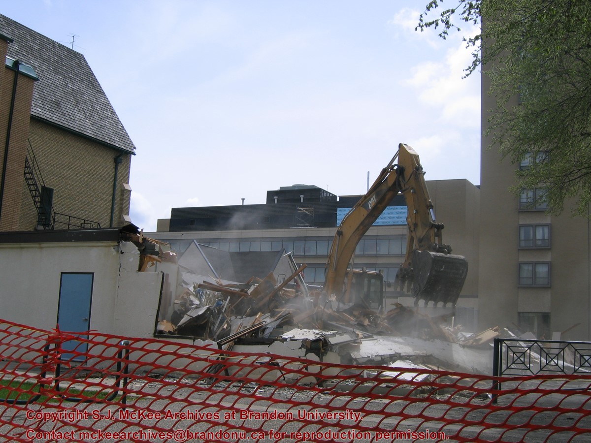
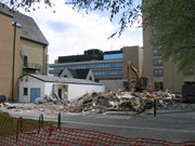
Located at the centre of the Brandon University campus, the Physical Plant H-Hut was destroyed following the opening of the new $3.9M, 13,600 square-foot physical plant on 07 April 2010.
Custodial History
Photograph was taken by McKee Archives project archivist Jill Sutherland.
Scope and Content
Photograph shows the demolition of the Physical Plant H-Hut. The photograph is looking southeast. The John R. Brodie Science Centre, the Geology H-Hut, and portions of the Citizens' Science Building (BUSU Building), Knowles-Douglas expansion (KDC) and McMaster Hall are visible in the background.


