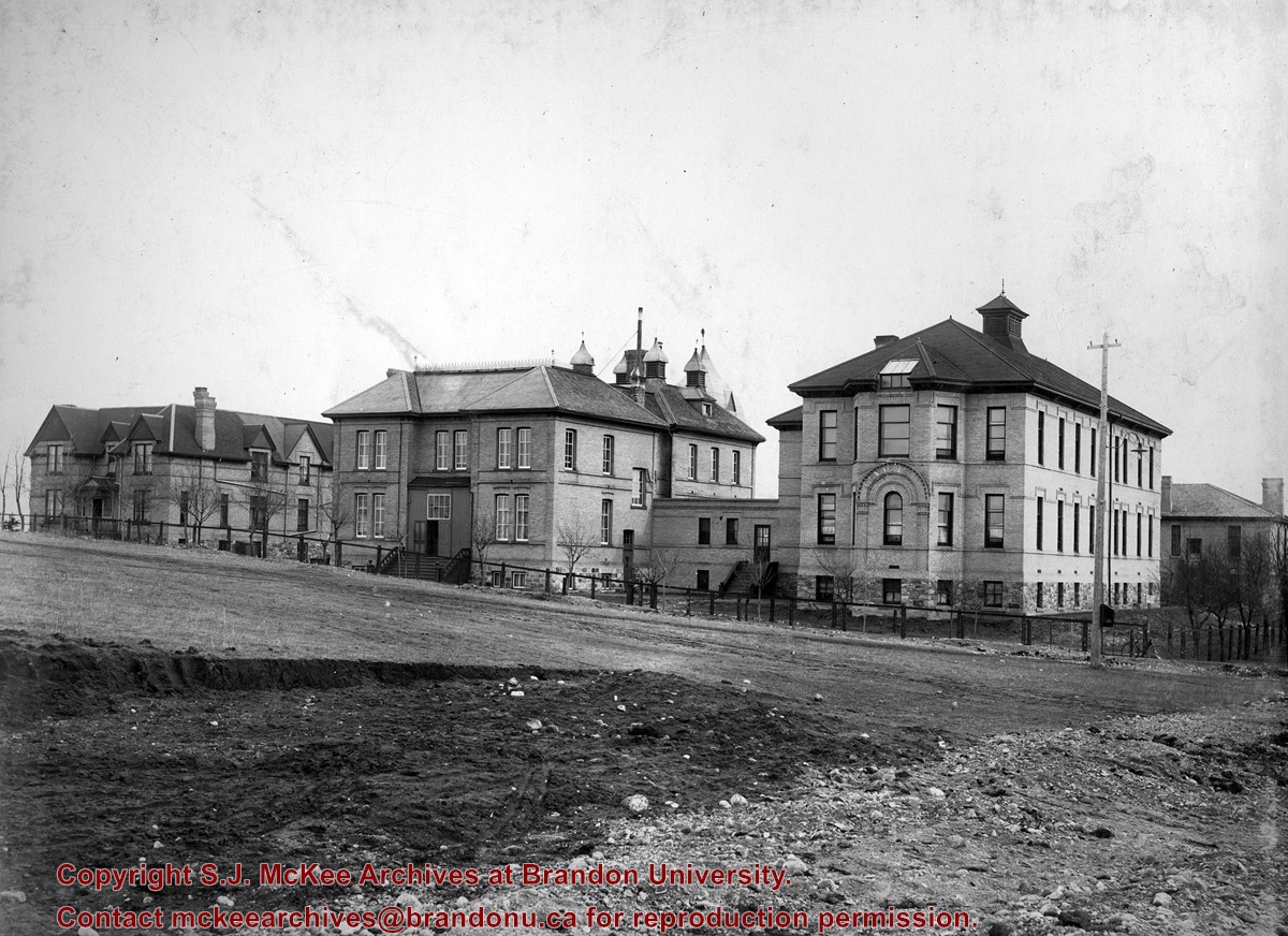
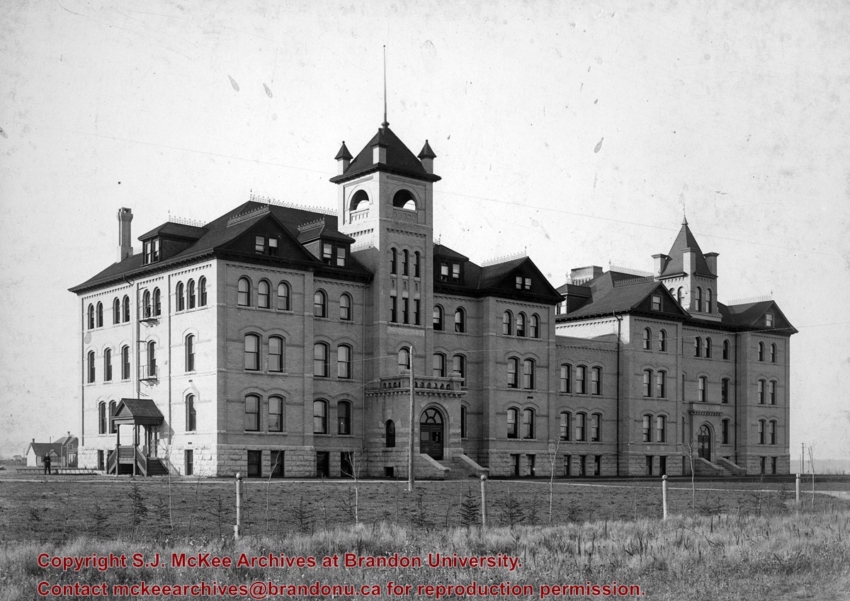
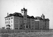
View is southwest. Photograph shows Clark Hall, the Brandon College Building, the Citizens' Science Building and the driveway running in front of the buildings. Portions of the front lawn and the Kinsmen Staduim are also visible.
View is northeast fron the west side of the Dining Hall. Photograph shows portions of the J.R.C. Evans Lecture Theatre and the A.E. McKenzie Building, as well as an H-Hut, Clark Hall, the Brandon College Building and the quadrangle.
View is north from approximately the Citizens' Science Building. Photograph shows the driveway running in front of the Brandon College Building and Clark Hall, a number of cars and students along the driveway and the Education Building in the background.
View is south from the lawn in front of the Education Building and shows a student exiting the building. The driveway and John R. Brodie Science Centre are visible in the background.
View is northwest from the front lawn. Photograph shows the Citizens' Science Building, an H-Hut, the Brandon College Building, Clark Hall and the original Music Building.
Photograph has a couple of cracks, due to bending.
Scope and Content
View is northwest from the front lawn. Photograph shows the Brandon College Building, Clark Hall, the parking lot in front of those two buildings and the Education building.
View is south southwest from approximatley the location of the current Health Studies Complex. Photograph shows the large field to the north of Clark Hall, Clark Hall, the Brandon College Building, the Citizens' Science Building and an H-Hut behind Clark Hall.
View is west northwest, probably from the roof of the Brandon College Building. Photograph shows an ice skating rink located in the field west of the Brandon College Building and Clark Hall. Some houses are visible in the background.
See fonds level description of the Alf Fowler collection for custodial history.
Scope and Content
Photo was taken from the 100 block of 10th Street looking north. At the bottom of 10th Street is the CPR Station. Also visible are the Canadian Bank of Commerce, the Cecil Hotel, The Sun, the Royal Bank of Canada and the awning on Davidson & Gowen.
Notes
An 11.75" x 8" (b/w) print of this photograph is located with the orignal at 6-1999.2. A digital scan of the photograph is available on a CD located in the Archives' office.
Storage Range
RG 5 Western Manitoba Manuscript collection - photograph storage drawer
See fonds level description of the Alf Fowler collection for custodial history.
Scope and Content
Photo was taken of 10th Street from Pacific Avenue looking sourth. Visible businesses include: the Cecil Hotel; the Canadian Bank of Commerce; Campbell and Campbell; and the Bank of British North America
Storage Range
RG 5 Western Manitoba Manuscript collection - photograph storage drawer
See fonds level description of the Alf Fowler collection for custodial history.
Scope and Content
Photo was taken of Rosser Avenue from 7th Street looking west. Visible businesses include: ? and Ball; Vincent & MacPherson; W.N. Finlay; Christie's; J. Burchill; the Empire Hotel; and Fleming's Drug Store. A number of people and vehicles are visible on both sides of the street.
Notes
A digital scan of the photograph is available on a CD located in the Archives' office.
Storage Range
RG 5 Western Manitoba Manuscript collection - photograph storage drawer
Brandon's City Hall and Opera House opened on New Year's Day 1892 with the Annual Fireman's Ball. The exterior of the building was designed by Brandon architect W.R. Marshall. At the south end was the Opera House, an auditorium formed by an internally exposed framework of delicate iron pillars and trusses. Demonlished in 1971, the limestone rubble of the foundations were turned into a sunken garden located in Princess Park.
Custodial History
See fonds level description of the Alf Fowler collection for custodial history.
Scope and Content
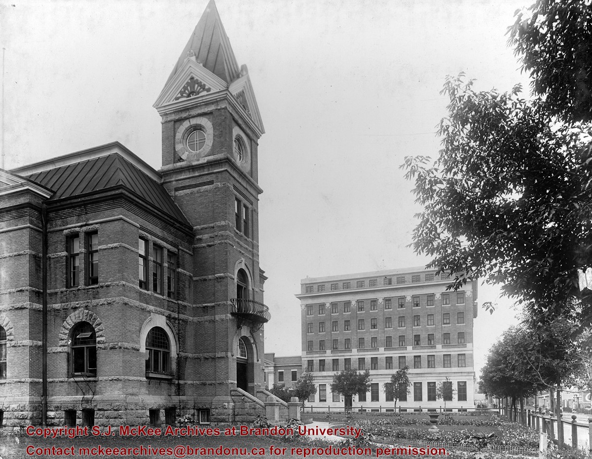
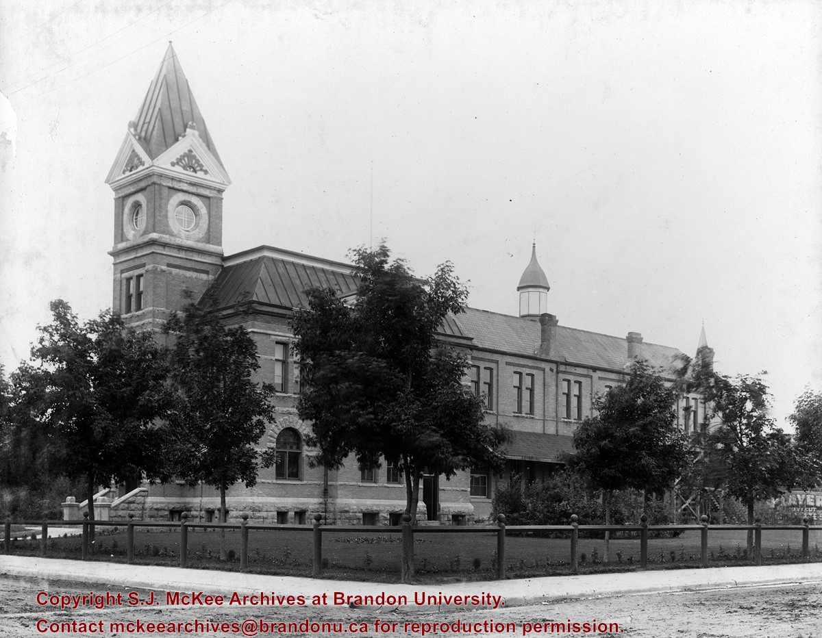
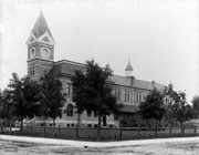
Photo was taken from the northwest corner of 9th Street and Princess Avenue and shows the west side of City Hall.
Notes
History/Bio information taken from the Assiniboine Historical Society's Brandon: An Architectural Walking Tour pamphlet (1982).
Location Copy
A 5" x 7" (b/w) reproduction of the photograph is located with the original.
Storage Range
RG 5 Western Manitoba Manuscript collection - photograph storage drawer
A piece of the photograph is missing on the left side. A small portion of one of the buildings is missing as a result.
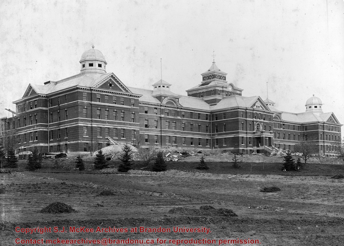
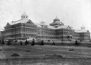
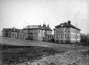
History / Biographical
The Brandon Insane Asylum was located on the north bank of the Assiniboine River, two miles north of Brandon. It had a southern aspect.
Custodial History
See fonds level description of the Alf Fowler collection for custodial history.
Scope and Content
Photo was taken looking northeast and shows the front and west side of the Brandon Insane Asylum. Construction materials are visible at the base of the building.
Notes
A 5" x 7" (b/w) reproduction of the photograph is located with the original.
Storage Range
RG 5 Western Manitoba Manuscript collection - photograph storage drawer


