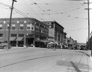
Photograph shows the north face of the Prince Edward Hotel on Princess Avenue. To the east of the hotel is Old City Hall with the military monument (which has since been relocated to the Brandon Armoury). On the west side of the hotel is Wheelers Esso Service Station.
Notes
The photograph appears to be taken from the Hughes Building on 10th Street.
Photograph shows Princess Avenue facing east from 10th Street. On the north side of Princess Avenue, a B/A Service Station, Princess Cafe, Lindenberg Seeds, and the Central Fire Station are visible. Old City Hall with the war memorial and the Prince Edward Hotel are visible on the south side of Princess Avenue. Traffic is travelling one-way on Princess Avenue.
Photograph shows the Greyhound Bus Depot at 11th Street and Princess Avenue. Western Motors, Wheelers Esso Station, and the Prince Edward Hotel are visible along the south side of Princess Avenue. Traffic is travelling one-way on Princess Avenue.
Photograph shows Western Motors Ltd. on the southwest corner of 10th Street and Princess Avenue. To the west of the car dealership/garage is the Greyhound Bus Station and its Maxwell House Cafe as well as the court house.
Photograph shows the west side of the 200-block on 10th Street. Visible businesses include: Chamber of Commerce Tourist Information, Dominion Tire & Radio Co., Bonnie's Bonnet Shop, Steve's Grill, Wally's Taxi, and Western Motors Ltd. The painted advertisement for Doig, Rankin and Robertson is visible on the Alexandra Block. Christmas ornaments are displayed from light standards and include Santa Claus and a Christmas elf.
Photograph shows the west side of the 200-block on 10th Street. Visible businesses include: Chamber of Commerce Tourist Information, Dominion Tire & Radio Co., Steve's Grill, Wally's Taxi, and the garage entrances to Western Motors Ltd. A Santa Claus Christmas ornament is displayed from a light standard.
Photograph shows the Red Indian (Gasoline) Station on the north side Princess Avenue between 9th and 10th Streets, Brandon. Attached to the west side of the gas station is another shop which contains Hutchings' Drug Store. The Alexandra Block on 10th Street is visible in the background.
Postcard shows an aerial view of 9th Street facing south in Brandon, Manitoba. Visible businesses and landmarks include: Beaubier Hotel, YMCA/police station, the original CKX Radio station towers on 8th Street (est. 1928 - moved 1940), the old City Hall, Prince Edward Hotel, and the original Manitoba Power commission smokestack on 10th Street.
Notes
Writing on the front of the photograph reads: Brandon, Man., Jerrett Photo. This photograph shows a rare view of the 800-block between Rosser and Princess Avenues.
Red ink stain is on the front right corner of postcard
Scope and Content
Photograph shows 10th Street facing south from Princess Avenue. Visible landmarks and businesses include: Manitoba Power Commission (MPC)'s power sub-station, First Baptist Church, Wheat City Arena, and the grand stand at the Exhibition Grounds.
The partial sign visible at the bottom of the photograph on the east side of 10th Street reads Yates and Neale, which refers to a plumbing and heating company that dissolved in 1943 to be replaced by Neale, Stothard and Chapman.
Businesses on the west side of 10th Street include: Dominion Tire & Radio Co., Bolts Barber Shop, Elviss T.E. Co. Stables.
Notes
Information concerning Yates and Neale courtesy Jack Stothard. Writing on the front of the postcard reads: Brandon, Looking S.W., Jerrett Photo. This photograph shows a rare view of the 200-block of 10th Street.
The Royal Bank moved to this location on 26 October 1929. An existing building was renovated to accomodate the bank. On 28 May 1976 fire destroyed the buildings from the lane west to the Royal Bank.
Scope and Content
Photograph shows the south side of Rosser Avenue between 7th and 8th Streets, west of the Eaton's building. Visible shops include: Vogue [Ladies Wear], Smith's Drugs, Sobie's Tailored Undergarnments, Household Finance Loans, and The Royal Bank of Canada.
Photograph shows the intersection at 10th Street and Princess Avenue, Brandon, Manitoba facing northwest. Visible businesses and buildings on the west side of 10th Street include: the Hughes Building, which house a possible grocery store and lunch coutner on the ground floor and Great-West Life Insurance on the second storey; Doig Store Ltd., Plaza Shoe Shop, Cambridge Clothes, the Alexandra Block, the Strathcona Block, and the Olympia Block.
A street car is travelling south on 10th Street. Angled parking is on both sides of 10th Street. Two-way traffic appears to be travelling on Princess Avenue. A stationary policeman/divider is in the centre of the intersection.
Photograph shows a sketch of the intersection at 10th Street and Princess Avenue, Brandon, Manitoba facing northeast. A proposed two-storey bowling alley is situated on the northeast corner of 10th Street and Princess Avenue.
Paper clip marks stain the top and bottom right corners
History / Biographical
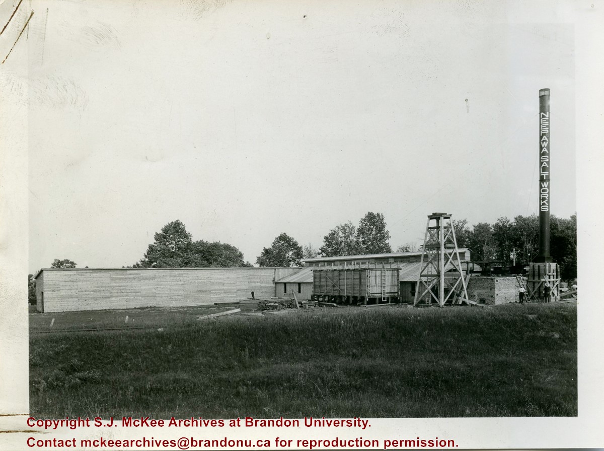
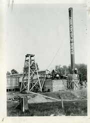
In 1932, the Neepawa Salt Company began producing salt from saline pools in the Neepawa area. According to Virgina Petch (2006), brine was pumped from two drilled wells and salt was extracted via vacuum pan evaporation process. (Source: "Salt-Making in Manitoba," Manitoba History Journal, No. 51, 2006)
Scope and Content
Photograph shows an overview of the salt well at the Neepawa Salt Works.
Paper clip marks stain the top and bottom right corners
History / Biographical
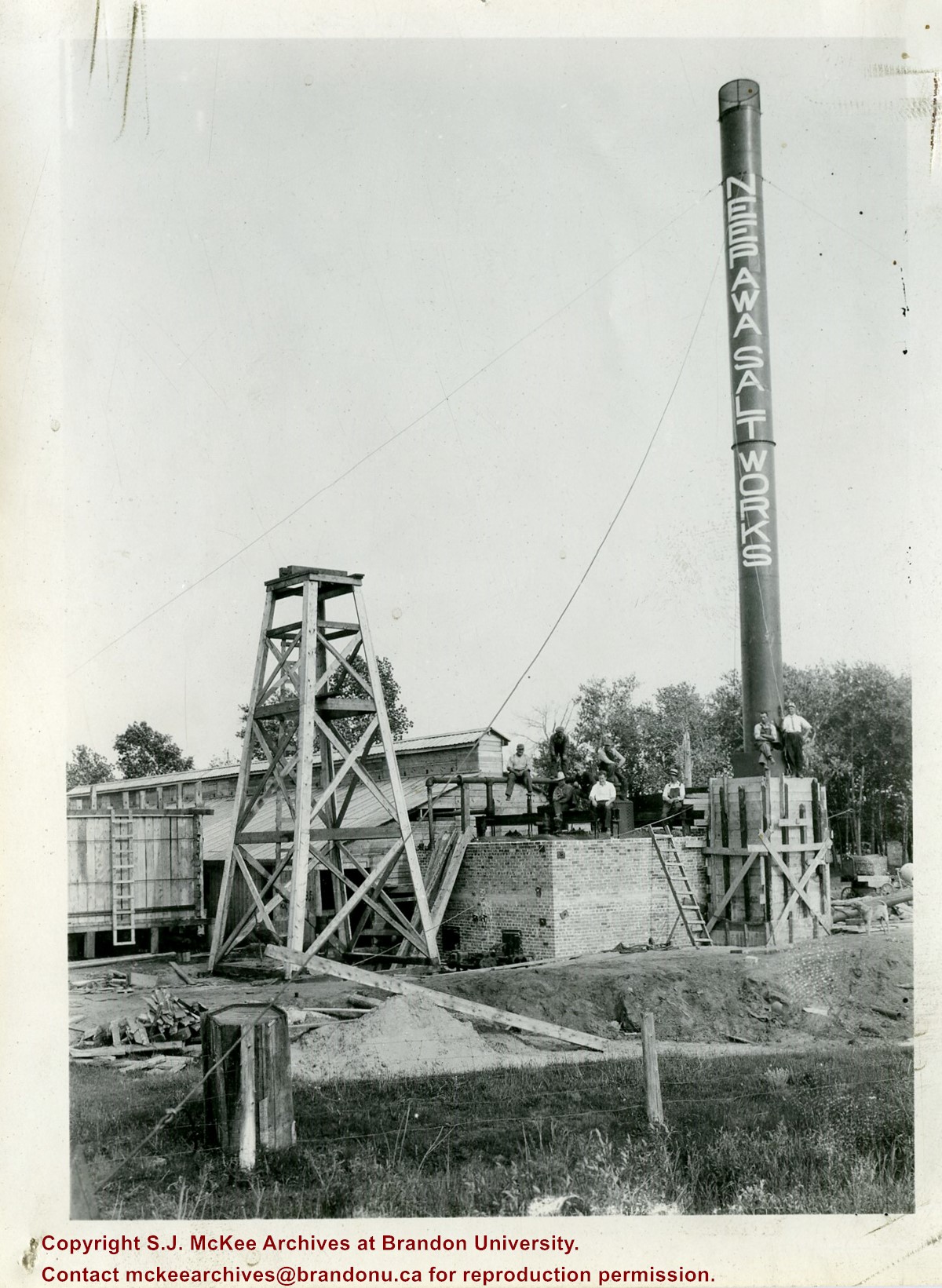
In 1932, the Neepawa Salt Company began producing salt from saline pools in the Neepawa area. According to Virgina Petch (2006), brine was pumped from two drilled wells and salt was extracted via vacuum pan evaporation process. (Source: "Salt-Making in Manitoba," Manitoba History Journal, No. 51, 2006)
Scope and Content
Photograph shows a close-up of a salt well pump at the Neepawa Salt Works.
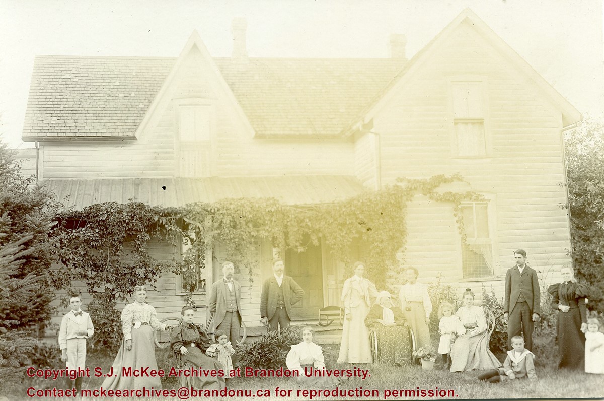
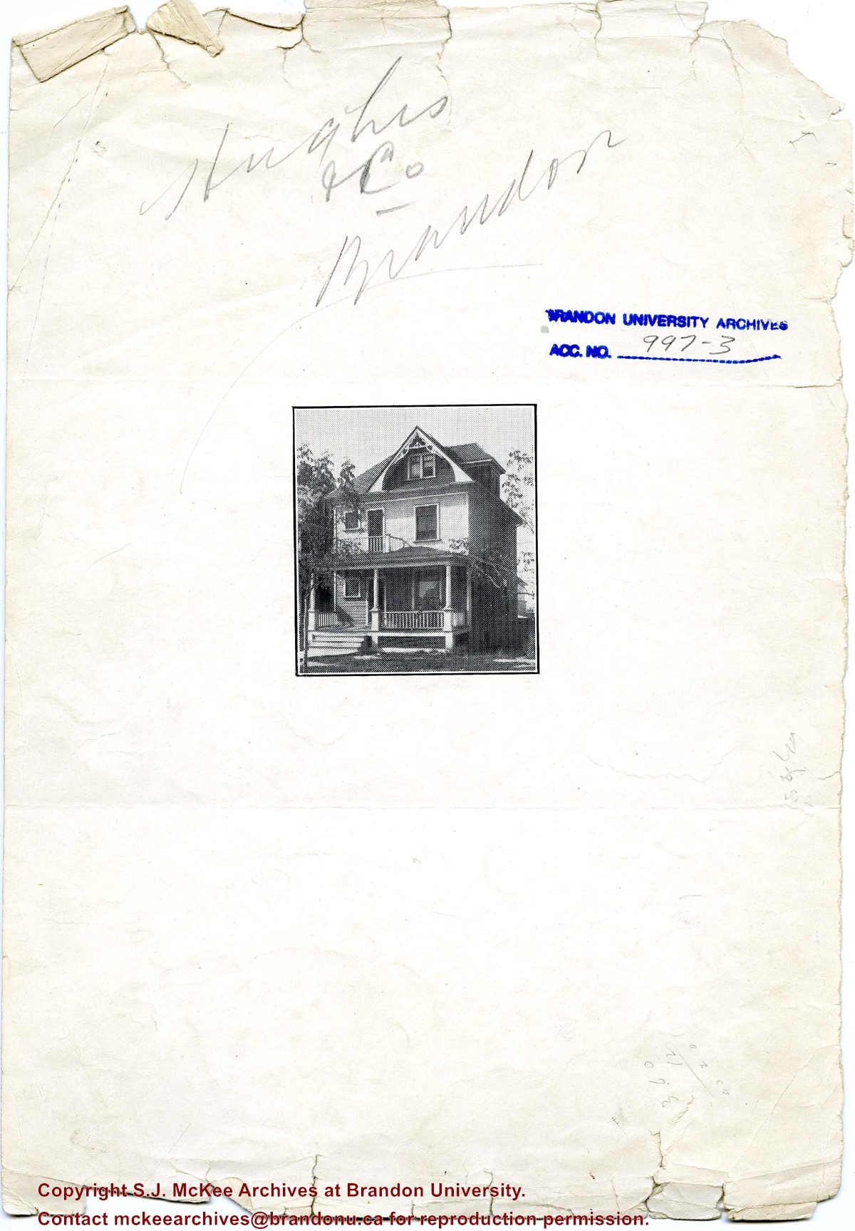
Photograph shows a multi-generational group of people standing outside in front of a wood-framed home. Individuals may possibly belong to the Hughes family.
Notes
Photograph stamped on the back: from the G. Marr Studio, Photos, Views, Frames, Crayon Portraits, &c., Strathroy, Ontario.
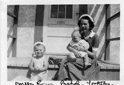
Photograph shows a young woman sitting on a porch step holding a baby. A toddler sits on the step to her right.
Notes
Writing on the front of photograph reads: Doreen Rouse Pachel, Yorkton. Writing on the back of photograph reads: Doreen Rouse Pachel with (Billy & Murray)
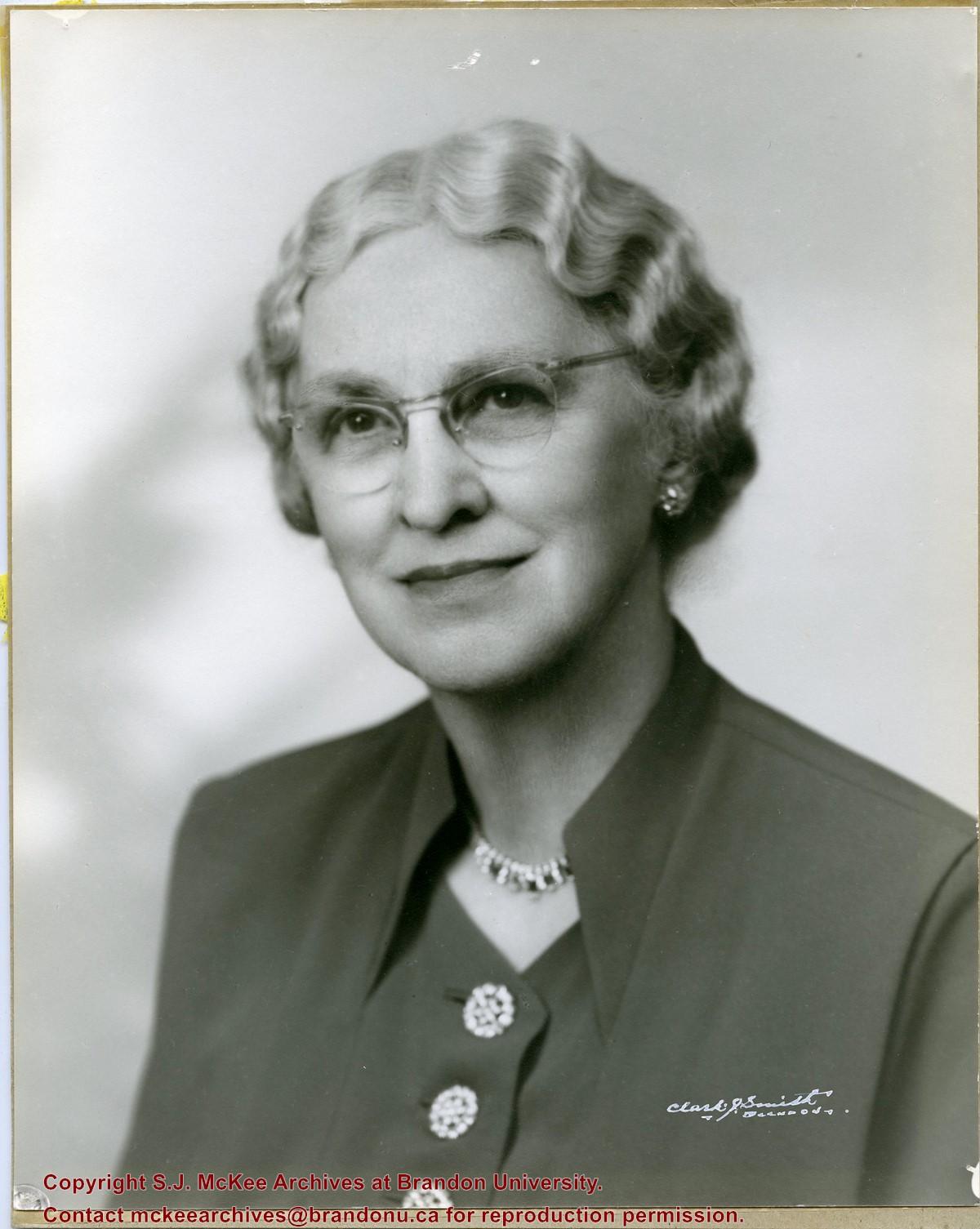
Photograph shows a portrait of an elderly woman with crimped hair and wearing classes. The woman has been identified as Elma Hughes, wife of Willard J. Hughes.
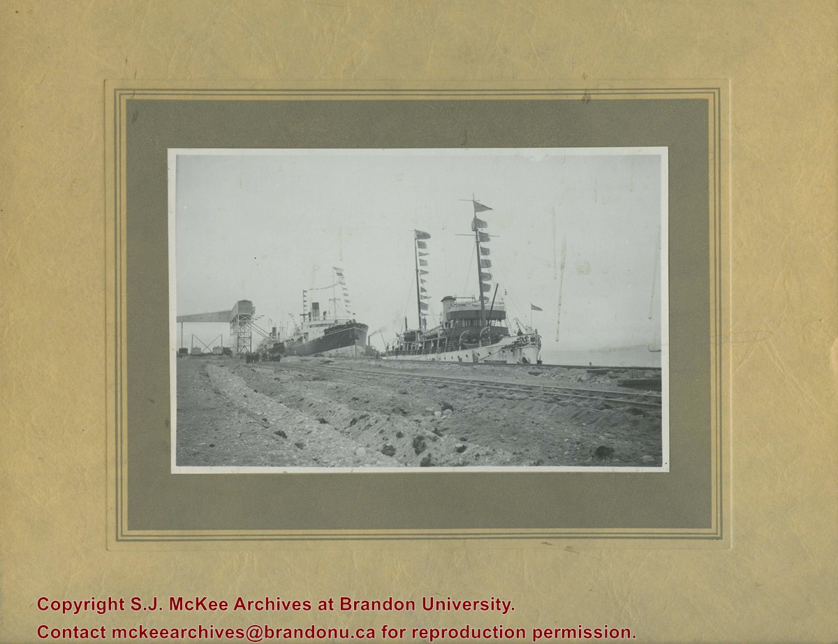
The CGS Acadia was a former hydrographic surveying and oceanographic research ship of the Canadian Hydrographic Service. The ship was used in the surveying work used to establish the port of Churchill.
Scope and Content
Photograph shows three steam ships docked in a port alongside railway tracks.
Notes
Writing on the back of the photograph reads: Churchill 1931 Sept 16 No. 3. Dr. Marion? Party. C.G.S. Acadia, S.S. Warkworth, S.S. Farnworth.


+north+side+Princess+Avenue+between+9th+Street+and+10th+Street%2c+Brandon%2c+Manitoba)