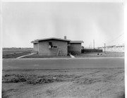
Photograph shows the construction of the McGuinness home in a new housing development in Medicine Hat, 492 6th Street Northeast. Painters appear to be working on the soffits.
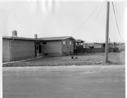
Photograph shows the construction of the McGuinness home in a new housing development in Medicine Hat, 492 6th Street Northeast. View is of the backyard and laneway.
For custodial history see the collection level description of the Lawrence Stuckey collection.
Scope and Content
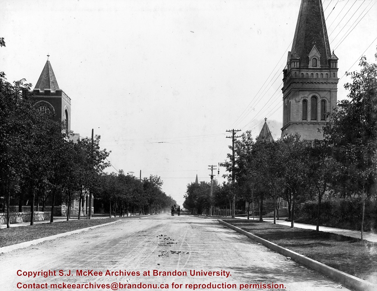
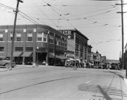
Northwest corner of Tenth Street and Rosser Avenue
Notes
Showing (left to right): Fraser Building 1890, John E. Smith Block 1907, The Canadian Bank of Commerce 1907, Cecil Hotel 1910, Brandon Sun Building 1905; Can be dated by Cecil Hotel (built 1910) and because the streets were paved and streetcar tracks laid in 1912.
Photograph given to Fred McGuinness by Helen Turner
Scope and Content
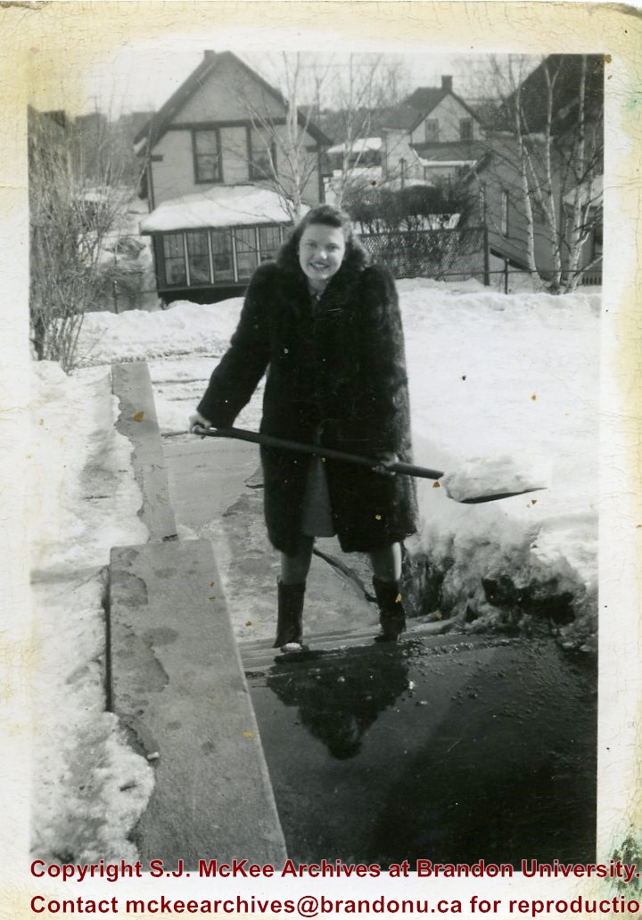
Photograph shows a man - George Porterfield - dressed in a three-piece and hat sitting at the reins of a horse drawn buggy. The buggy appears to be parked on Lorne Avenue beside the bandstand at Stanely Park.
Notes
Note attached to the back of the photograph reads: This George Porterfield, who lived on a farm 4.9.19. Delivered eggs, cream & milk in Brandon by this method in the early 1920. Maybe he was out courting Mary, he looks pretty dressed up.
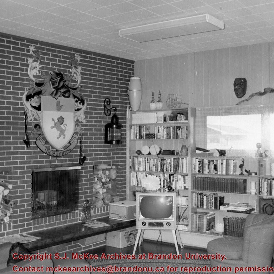
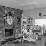
Photograph shows the interior of the McGuinness home (492 6th Street Northeast) in a new housing development in Medicine Hat. The living room has brickfaced fireplace above which there is a large McGuinness coat of arms.
Notes
A negative exists for this photo and is stored with the picture.
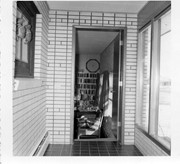
Photograph shows the interior of the McGuinness home (492 6th Street Northeast) in a new housing development in Medicine Hat. This view shows an entrance to a possible den.
Notes
A negative exists for this photo and is stored with the picture.
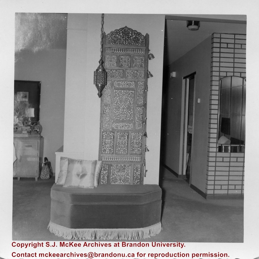
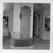
Photograph shows the interior of the McGuinness home (492 6th Street Northeast) in a new housing development in Medicine Hat. This view shows a decorative panel, lamp, and upholstered bench.
Notes
A negative exists for this photo and is stored with the picture.
The Brandon Club (L. of center) was built in 1904. This local businessmen's club met in the old firehall until this building was erected by them.
[The Brandon Club closed and its assets were sold at auction on 18 June 2005. P.E. 01/06/2009]
Custodial History
For custodial history see the collection level description of the Lawrence Stuckey collection.
Scope and Content
Overhead view of Princess Avenue, west of 10th Street
Notes
Taken from roof of Prince Edward Hotel. Shows: Rat Portage Lumber Co., St. Matthew's Hall, Brandon Club, In distance Brandon College, International Harvester, Pumping Station. End of brick pavement at 14th Street is notable.
Photograph shows the intersection at 10th Street and Princess Avenue, Brandon, Manitoba facing northwest. Visible businesses and buildings on the west side of 10th Street include: the Hughes Building, which house a possible grocery store and lunch coutner on the ground floor and Great-West Life Insurance on the second storey; Doig Store Ltd., Plaza Shoe Shop, Cambridge Clothes, the Alexandra Block, the Strathcona Block, and the Olympia Block.
A street car is travelling south on 10th Street. Angled parking is on both sides of 10th Street. Two-way traffic appears to be travelling on Princess Avenue. A stationary policeman/divider is in the centre of the intersection.
For custodial history see the collection level description of the Lawrence Stuckey collection.
Scope and Content
View of the southeast corner of Tenth Street and Princess Avenue, showing the Prince Edward Hotel (left) and an Imperial Oil Building (right).
Notes
The second floor of the Imperial Oil building became the Imperial Dance Garden in 1934. The small wooden post in a concrete foundation in the centre of the intersection was called a "Silent Policeman". You were supposed to keep it on your left while making a left turn. They took quite a beating.
[Information in "Notes" provided by the Fred McGuinness collection (20-2009).]
Corners of photograph mat are bent. Picture is cracked.
Scope and Content
Photograph shows an early view of Brandon's 6th Street in the 1880s. The Winter & O'Neail Groceries & Provisions and James Smart Hardware storefronts have been photographed. A street sign designating 6th Street can be seen below the Winter & O'Neail sign. A horse and cart is parked in front of the grocery store. A number of men wearing hats and jackets are standing along the boardwalk while posing for the picture. Lumber/timber saws are displayed in teh windows of the hardware store.
Notes
Front of photograph reads: 6th Street, Brandon, Manitoba, 1881-1882, Entrance [to Winter & O'Neail] corner of Rosser Ave & 6th Street.


.jpg?width=1200&404=no-img.jpg&watermark=wmk)
.jpg?width=180&404=no-img.jpg)


.jpg?width=1200&404=no-img.jpg&watermark=wmk)
.jpg?width=180&404=no-img.jpg)


)
.jpg%3fmaxheight%3d1000%26maxwidth%3d1000%26watermark%3dwmk&description=Princess+Avenue+east+of+Tenth+Street)
.jpg%3fmaxheight%3d1000%26maxwidth%3d1000%26watermark%3dwmk&description=Pacific+Avenue+-+west+of+Tenth+Street)