Image shows the Brandon College campus from 17th Street looking southwest. The photo was taken after the completion of the original Music Building in 1963, but construction of the Education Building. Also visible are a number of properties on the 200 block of 18th Street and the 200 block of 20th Street.
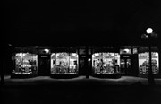
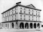
The Metropolitan store was located on the south side of Rosser Avenue at 8th Street.
Scope and Content
Photograph shows the front of the Metropolitan Store Ltd. at night, in particular four large display windows displaying men's and women's apparel and baked goods. Signs in the windows read: Grand opening sale Friday and Saturday.
Repro Restriction
The McKee Archives is the copyright holder for the Stuckey materials.
Photograph shows the Greyhound Bus Depot at 11th Street and Princess Avenue. Western Motors, Wheelers Esso Station, and the Prince Edward Hotel are visible along the south side of Princess Avenue. Traffic is travelling one-way on Princess Avenue.
Image is looking east northeast from approximately the 300 block of 23rd Street between Lorne and Louise Avenues. Photograph shows the Brandon College campus after the opening of the original Music Building in 1963, but before the construction of the Education Building in 1966. A number of house on the 300 blocks of 22nd and 21st Streets are visible in the foreground, with the A.E. McKenzie Seed Co., the Prince Edward Hotel and various grain elevators on the horizon.
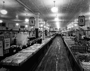
The Metropolitan store was located on the south side of Rosser Avenue at 8th Street.
Scope and Content
Photograph shows counters 5-6, 8-13 and 15-17 on the Metropolitan Store Ltd. sale floor. Various opening specials are advertised, including: bloomers, hose, shirts, toilet shop, powder, spectacles, alarm clocks and bulbs.
Repro Restriction
The McKee Archives is the copyright holder for the Stuckey materials.
Photograph shows Princess Avenue facing east from 10th Street. On the north side of Princess Avenue, a B/A Service Station, Princess Cafe, Lindenberg Seeds, and the Central Fire Station are visible. Old City Hall with the war memorial and the Prince Edward Hotel are visible on the south side of Princess Avenue. Traffic is travelling one-way on Princess Avenue.
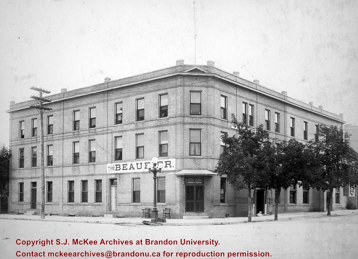
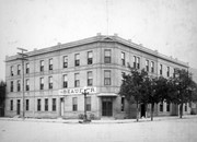
Postcard shows an aerial view of 9th Street facing south in Brandon, Manitoba. Visible businesses and landmarks include: Beaubier Hotel, YMCA/police station, the original CKX Radio station towers on 8th Street (est. 1928 - moved 1940), the old City Hall, Prince Edward Hotel, and the original Manitoba Power commission smokestack on 10th Street.
Notes
Writing on the front of the photograph reads: Brandon, Man., Jerrett Photo. This photograph shows a rare view of the 800-block between Rosser and Princess Avenues.
The International Peace Garden is situated on the international border between Manitoba and North Dakota, adjacent to the Canadian Border Services Boissevain port of entry and the U.S. Customs and Border Protection Agency's Dunseith port of entry. The dedication for the International Peace Garden was held on July 14, 1932. It was estimated that 50,000 people were in attendance on opening day. The park is 9.5-square kilometers or 3.54-square miles.
Custodial History
Pictures were sent to Fred McGuinness in 1970 from E.M. Bergson of Brandon.
Scope and Content
Photograph shows large crowds surrounding a stone cairn draped in American and Union Jack flags. According to the International Peace Garden website, the pictured cairn was built from stones gathered from Manitoba and North Dakota. The crowds gathered for the 1932 dedication of the International Peace Garden.
Notes
The back of the photograph is stamped: Enameloid Velox Print by the Jul 27 1932, Chicago Postal Photo Supplies, Regina, Sask.
The International Peace Garden is situated on the international border between Manitoba and North Dakota, adjacent to the Canadian Border Services Boissevain port of entry and the U.S. Customs and Border Protection Agency's Dunseith port of entry. The dedication for the International Peace Garden was held on July 14, 1932. It was estimated that 50,000 people were in attendance on opening day. The park is 9.5-square kilometers or 3.54-square miles.
Custodial History
Pictures were sent to Fred McGuinness in 1970 from E.M. Bergson of Brandon.
Scope and Content
Photograph shows the crowded parking lot at the International Peace Garden's 1932 dedication ceremony. People mill amongst the automobiles and tents can be seen in the background.
Notes
The back of the photograph is stamped: Enameloid Velox Print by the Jul 27 1932, Chicago Postal Photo Supplies, Regina, Sask.
Photograph shows a panorama, bird's-eye-view of downtown Brandon, between Pacific and Rosser Avenues and 7th Street facing east. Photoraph likely taken from the McKenzie Seeds Building. Visible businesses include: Western Canada Flour Mills, Hanbury Hardware Co. Ltd., Cockshutt Plow Co., New Pacific Hotel, Gordon McKay Building, and Arlington Hotel.
Notes
Part of "Souvenir of Brandon, Manitoba, Canada [viewbook], Printed by Photogelatine Engraving Co. Limited, Ottawa." Dates obtained from the Burchill's Music Store Henderson's Brandon City Directory listings (1927-1929). Writing on the front of the photograph reads: Panorama of Brandon, Man.
Red ink stain is on the front right corner of postcard
Scope and Content
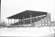
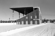
Photograph shows 10th Street facing south from Princess Avenue. Visible landmarks and businesses include: Manitoba Power Commission (MPC)'s power sub-station, First Baptist Church, Wheat City Arena, and the grand stand at the Exhibition Grounds.
The partial sign visible at the bottom of the photograph on the east side of 10th Street reads Yates and Neale, which refers to a plumbing and heating company that dissolved in 1943 to be replaced by Neale, Stothard and Chapman.
Businesses on the west side of 10th Street include: Dominion Tire & Radio Co., Bolts Barber Shop, Elviss T.E. Co. Stables.
Notes
Information concerning Yates and Neale courtesy Jack Stothard. Writing on the front of the postcard reads: Brandon, Looking S.W., Jerrett Photo. This photograph shows a rare view of the 200-block of 10th Street.


.jpg?width=1200&404=no-img.jpg&watermark=wmk)
.jpg?width=180&404=no-img.jpg)


.jpg%3fmaxheight%3d1000%26maxwidth%3d1000%26watermark%3dwmk&description=Northeast+view+from+100+block+of+Tenth+Street)