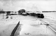
This bridge was condemned in the late 1930s but cyclists continued to use it until it was torn down (approximately 1940)
Until the early 1920s the Canadian Pacific Railway maintained a well and pumping station near the southeast corner of this bridge, which pumped water through a pipeline to a locomotive watering tank at Kemnay.
Custodial History
For custodial history see the collection level description of the Lawrence Stuckey collection.
Scope and Content
Assiniboine River Bridge North of Kemnay
Notes
[Mr. Stuckey put a negative and print in the same envelope. We have separated them, numbering the negative OB5(1) and the print OB5(1a).]
For custodial history see the collection level description of the Lawrence Stuckey collection.
Scope and Content
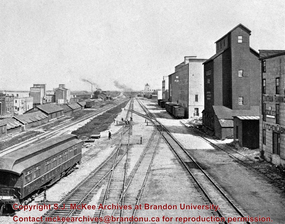
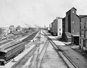
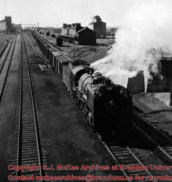
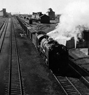
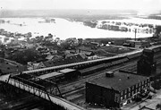
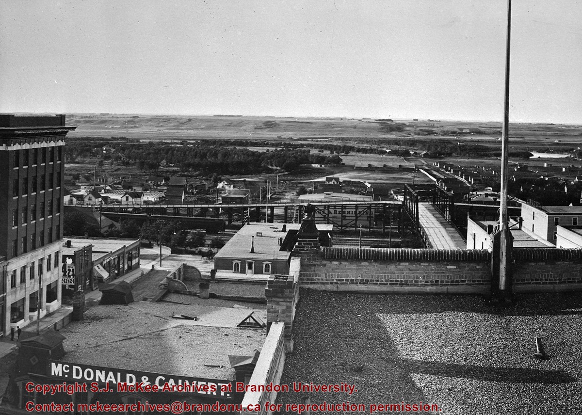
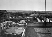
View of Canadian Pacific Railway, east from overhead [Eighth Street] bridge
Notes
Publicity coach of Sells-Floto Circus (foreground)
On left, a long row of domestic fuel coal sheds (many of which were later burned), Hanbury's Mill, elevators & Maple Leaf flour mill
On right, grain elevator & Hanbury Hardware (in 1985 used by Christie School Supply)
[For original plate, please see the Alf Fowler collection of the S.J. McKee Archives 6-1999.16. P.E.]
See fonds level description of the Alf Fowler collection for custodial history.
Scope and Content
Photo was taken of Rosser Avenue from 7th Street looking west. Visible businesses include: ? and Ball; Vincent & MacPherson; W.N. Finlay; Christie's; J. Burchill; the Empire Hotel; and Fleming's Drug Store. A number of people and vehicles are visible on both sides of the street.
Notes
A digital scan of the photograph is available on a CD located in the Archives' office.
Storage Range
RG 5 Western Manitoba Manuscript collection - photograph storage drawer
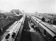
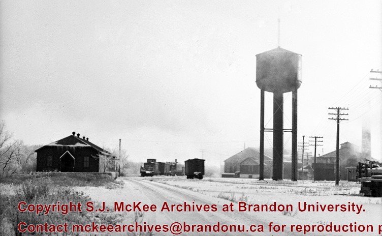
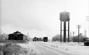
Stuckey's notes: Date determination: Engine 93, ex 375 received Series 2 numbering Sept. 1907 and repainting is still clean; some trees have leaves so could be Sept. 1907 but more likely about May 1908.
Scope and Content
Photograph is looking west along the CPR tracks. Trains at the station have both freight and passenger cars - freight and baggage is being loaded, while people are both arriving and departing.
Notes
Corresponds with negative 1-2002.3.9.P8.
Repro Restriction
The McKee Archives is the copyright holder for the Stuckey materials.
[The land on which city hall stood in this photo is now known as Princess Park. P.E. 01/06/09]
Custodial History
For custodial history see the collection level description of the Lawrence Stuckey collection.
Scope and Content
Princess Avenue, showing City Hall & CKX radio tower
Notes
[View is from 9th Street looking east. P.E.]
"Radio towers of CKX on city hall grounds were 150 feet tall; Studio and transmitter were on the east side of city hall." - Fred McGuinness collection (20-2009).
For custodial history see the collection level description of the Lawrence Stuckey collection.
Scope and Content
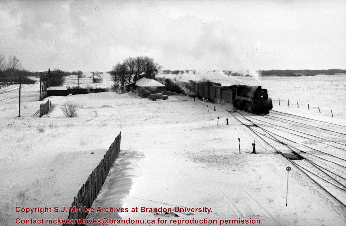
CPR No. 3, the westbound "Dominion", with engine 2829 under 1st Street Bridge
Notes
View includes former Empire Brewery, [then] in use by Bell Bottling Co.; Safe crossing over the CPR eliminated the need for a flagman. "Telltails" warn switchmen riding on top of railcars of low overhead clearance. Old Empire Brewery was (late 1950's) a feed mill, making grain feeds for livestock.
Photograph shows the 800 block of Rosser Avenue facing west. On the south side of Rosser Avenue the Nation Block, Christie's Bookstore, and Reesor's Clock can be seen. A number of horse and buggies/carriages are travelling along Rosser Avenue.
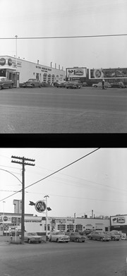
Photograph of west side of 10th Street, Brandon, Manitoba, facing northwest. Visible businesses in the Alexandra Block include Doig's, Box Brothers Hardware and Allied Hardware Stores, followed by Simpsons-Sears and Barry Neill Men's Wear in the Strathcona Block. The Johnny Smith Block is visible in the background.
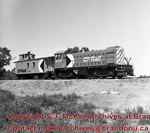
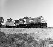
Stuckey's notes: These units were donated to City of Brandon by CPR as a Centennial Gift. Installed in park July 27, 1982. (And came under relentless attacks by vandals.)
Scope and Content
Photograph shows the engine and caboose in Dinsdale Park.
Notes
Corresponds with negative 1-2002.3.9.P29.
Repro Restriction
The McKee Archives is the copyright holder for the Stuckey materials.
Bridge built by the Canadian Pacific Railway and presented to City of Brandon in 1904 in exchange for permission to close the level crossing at Sixth Street; Iron cantilever bridge over tracks; Two timber trestles each two blocks long running east and west connected to Assiniboine Avenue; Pedestrian stairway connected to Eight Street North
West approach torn down August 1934 and timber used to resurface East approach
Custodial History
For custodial history see the collection level description of the Lawrence Stuckey collection.
Scope and Content
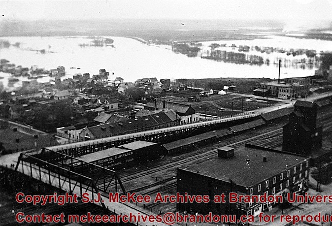
View of original Eighth St. bridge from Christie Building, including East and West ramp approaches from Assiniboine Ave.
Notes
Photographer I.C. Barton from Chicago Illinois.
Additional historical information provided by Fred McGuinness collection (20-2009).
Doig's, originally located on Rosser Avenue, moved to the 10th Street location in 1921.
Scope and Content
Photograph of west side of 10th Street, Brandon, Manitoba, facing northwest. Visible businesses in the Alexander Block include Doig's, Box Brothers Hardware and Allied Hardware Stores, followed by Simpsons-Sears and Barry Neill Men's Wear in the Strathcona Block. The Johnny Smith Block is visible in the background.
.jpg?width=1200&404=no-img.jpg&watermark=wmk)
.jpg?width=180&404=no-img.jpg)
.jpg?width=1200&404=no-img.jpg&watermark=wmk)
.jpg?width=180&404=no-img.jpg)
.jpg?width=1200&404=no-img.jpg&watermark=wmk)
.jpg?width=180&404=no-img.jpg)


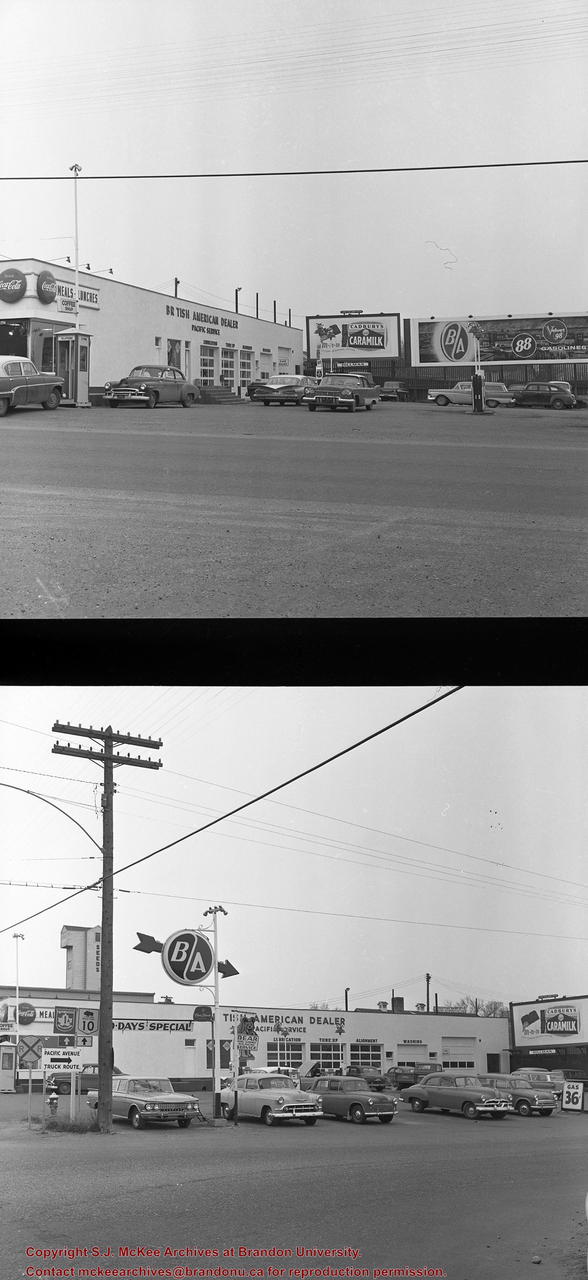


.jpg%3fmaxheight%3d1000%26maxwidth%3d1000%26watermark%3dwmk&description=Pacific+Avenue+-+west+of+Tenth+Street)
.jpg%3fmaxheight%3d1000%26maxwidth%3d1000%26watermark%3dwmk&description=Assiniboine+River+Bridge+North+of+Kemnay)
.jpg%3fmaxheight%3d1000%26maxwidth%3d1000%26watermark%3dwmk&description=Assiniboine+River+Bridge+North+of+Kemnay)
)